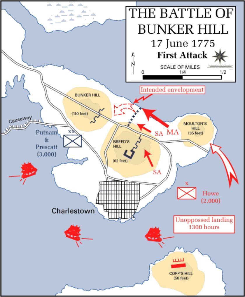
First attack
U.S. Military Academy, Department of History (West Point) · 20th century
Public domain (U.S. government work) · U.S. Military Academy history atlas
Every period map used to place the units in Battlefield Atlas, free to download. Get the full-resolution original from the library or archive that holds it, or our copy exactly as used on the map. Members can also download each georeferenced map as a Google Earth file, pinned to the real ground.
The Google Earth files are part of membership. Sign in on the atlas with Patreon or Kick, or join for $3 a month on Patreon, then come back to this page.
Campaign and battle maps drawn by West Point's Department of History for teaching cadets.
U.S. Military Academy, Department of History (West Point) · 20th century
Public domain (U.S. government work) · U.S. Military Academy history atlas
U.S. Military Academy, Department of History (West Point) · 20th century
Public domain (U.S. government work) · U.S. Military Academy history atlas
U.S. Military Academy, Department of History (West Point) · 20th century
Public domain (U.S. government work) · U.S. Military Academy history atlas
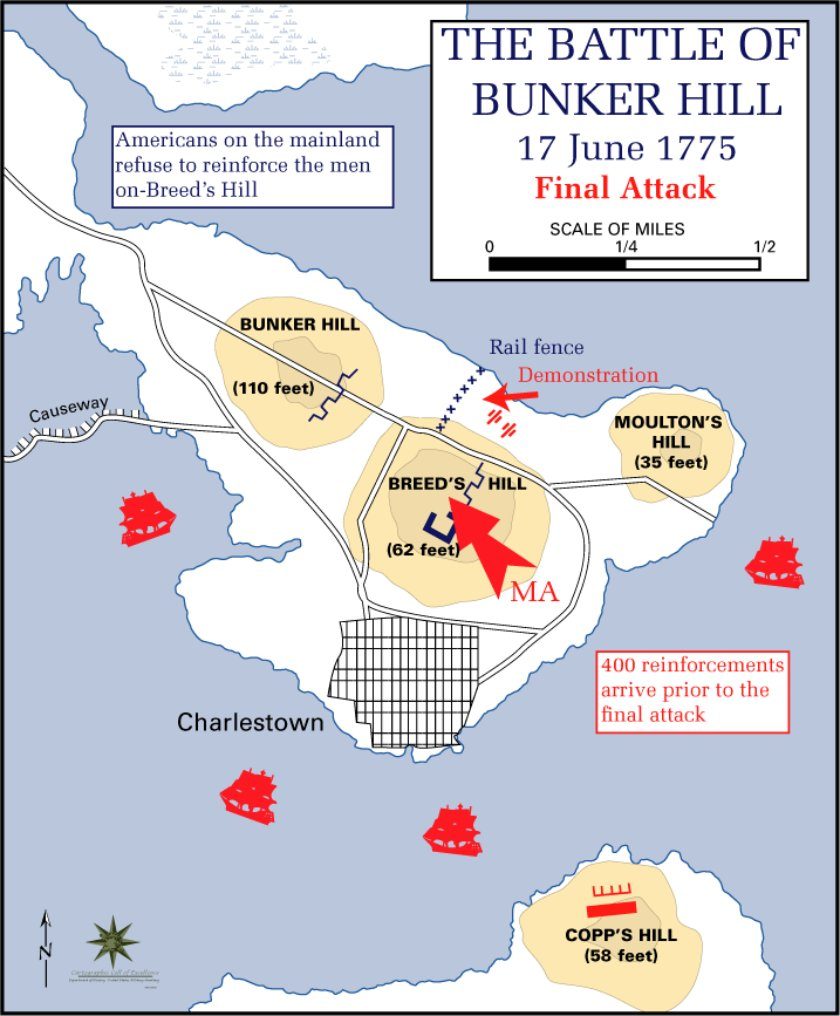
Campaign and battle maps drawn by West Point's Department of History for teaching cadets. Modern unit arrays on shaded relief, after the National Park Service's interpretation of the battlefield.
U.S. Military Academy, Department of History (West Point) · 20th century
Public domain (U.S. government work) · U.S. Military Academy history atlas
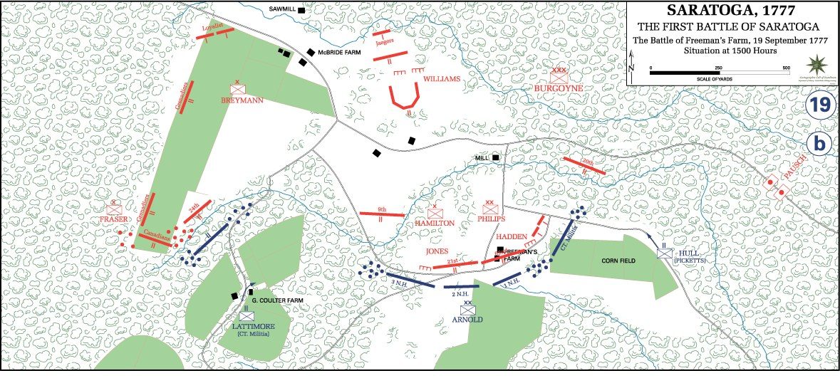
U.S. Military Academy, Department of History (West Point) · 20th century
Public domain (U.S. government work) · U.S. Military Academy history atlas
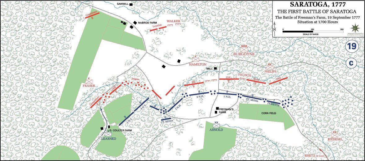
U.S. Military Academy, Department of History (West Point) · 20th century
Public domain (U.S. government work) · U.S. Military Academy history atlas
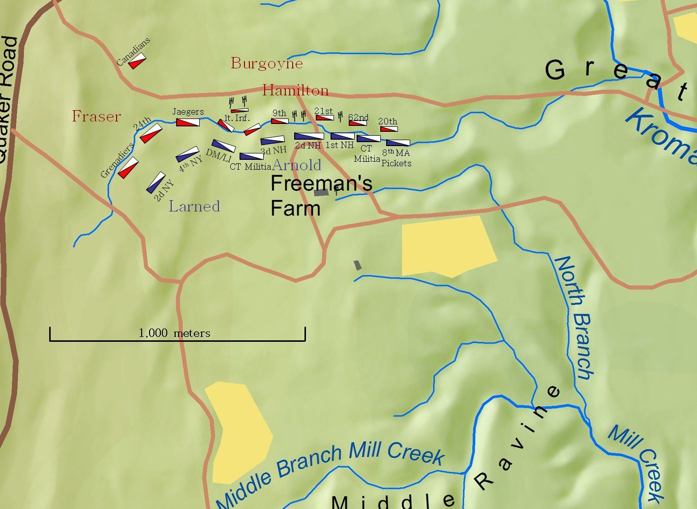
Charles E. Frye · 2005
CC BY-SA 3.0 · Wikimedia Commons
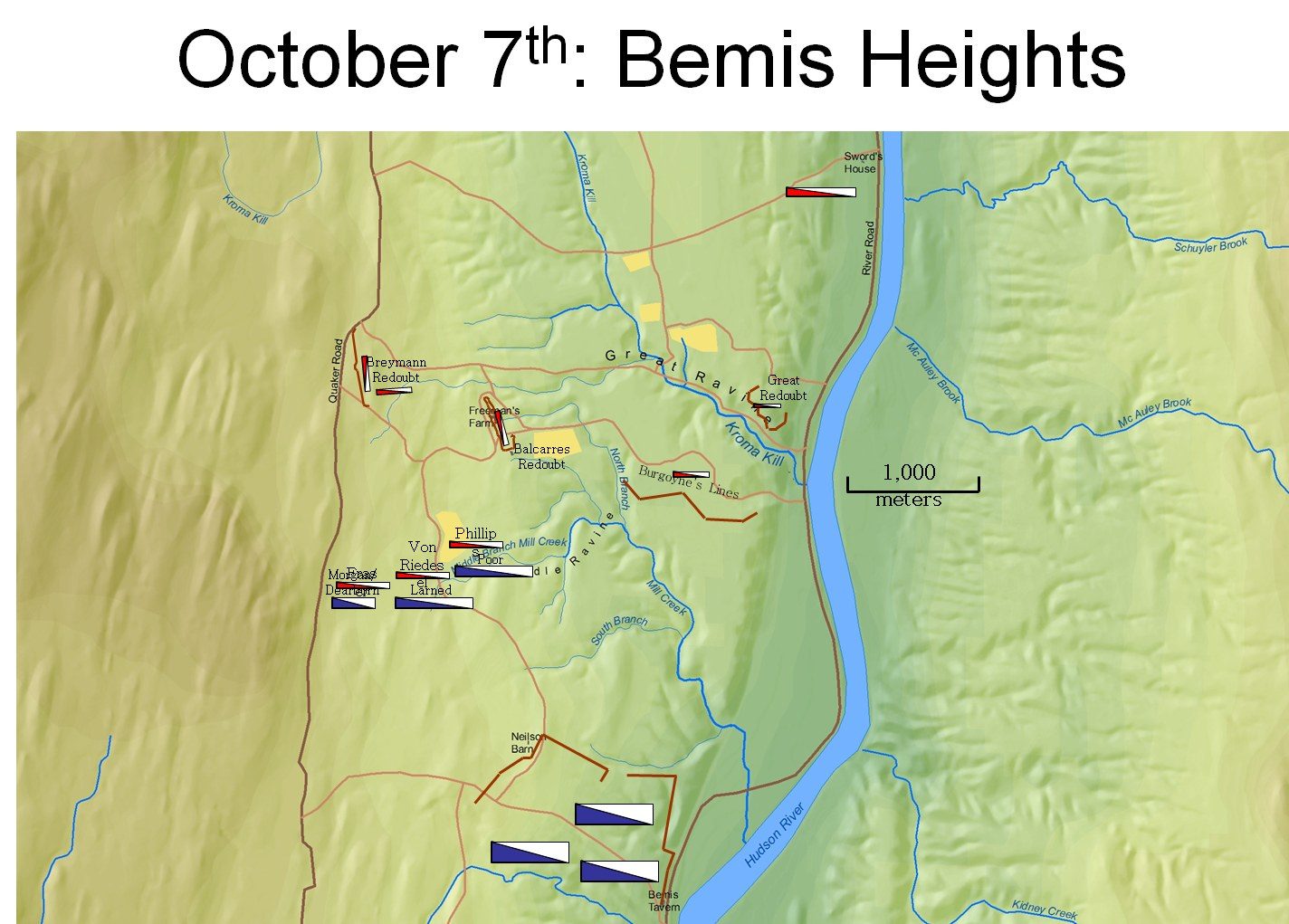
Charles E. Frye · 2005
CC BY-SA 3.0 · Wikimedia Commons
Campaign and battle maps drawn by West Point's Department of History for teaching cadets.
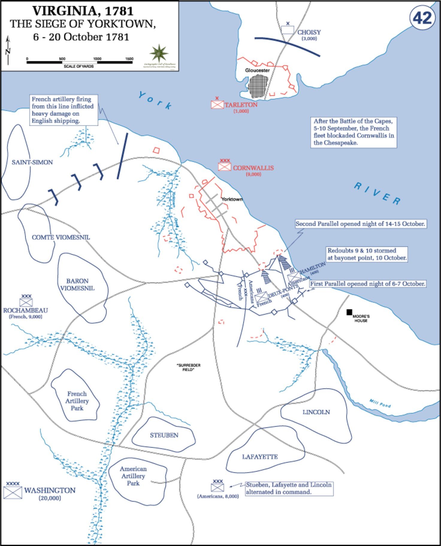
U.S. Military Academy, Department of History (West Point) · 20th century
Public domain (U.S. government work) · U.S. Military Academy history atlas
Craan surveyed the field within months of the battle and plotted every unit from officers' accounts. It is the earliest detailed plan of Waterloo and the source of the positions in the atlas. A clear later plan of the armies before the battle and at 8 PM.
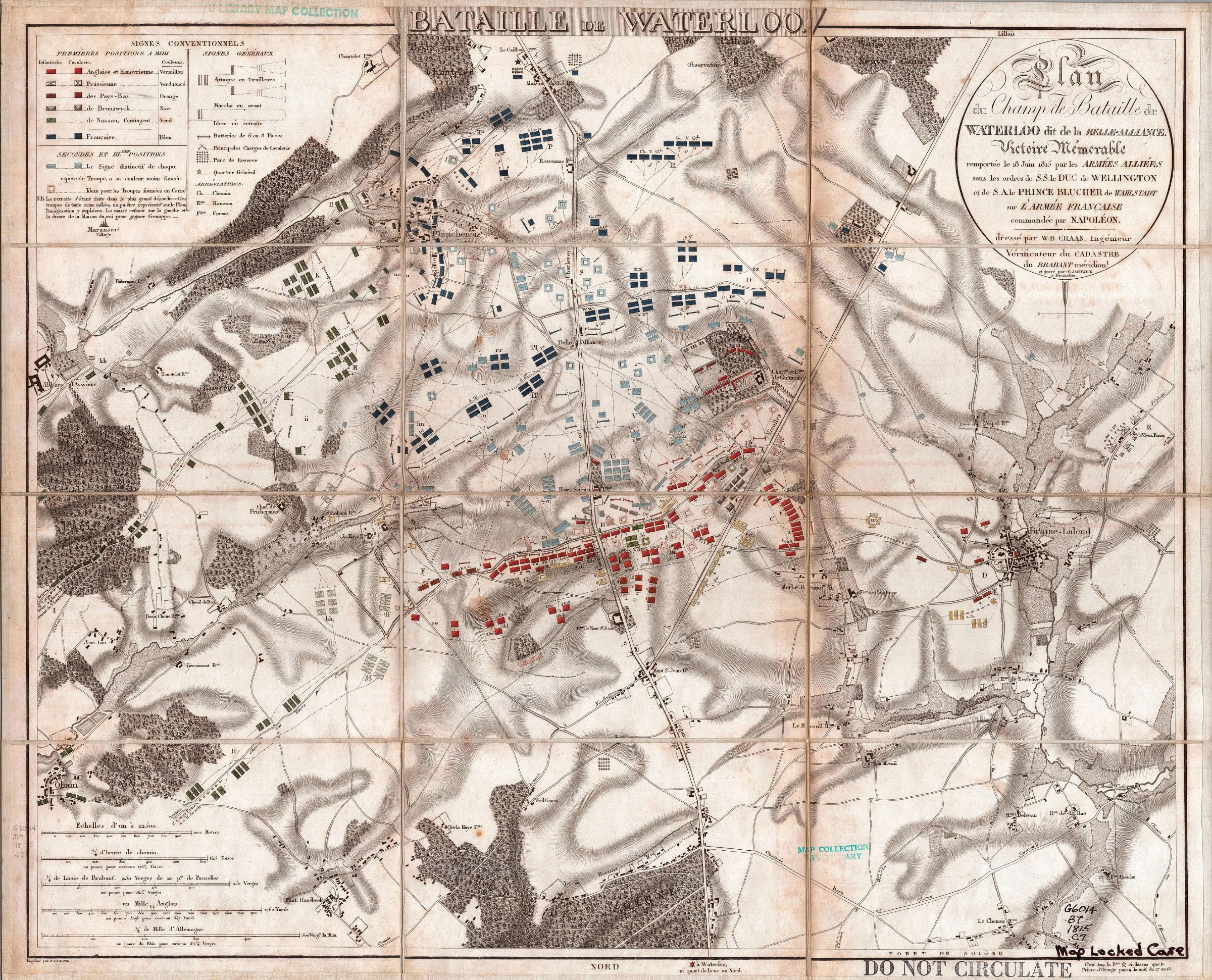
Willem Benjamin Craan · 1816
Public domain · Internet Archive scan, via Wikimedia Commons
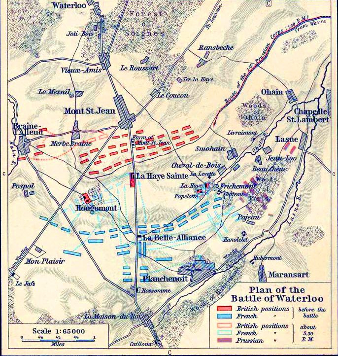
Unknown (late 19th-century historical atlas) · late 19th century
Public domain · Wikimedia Commons
Modern phase maps by Civil War cartographer Hal Jespersen, based on the official records and park research.
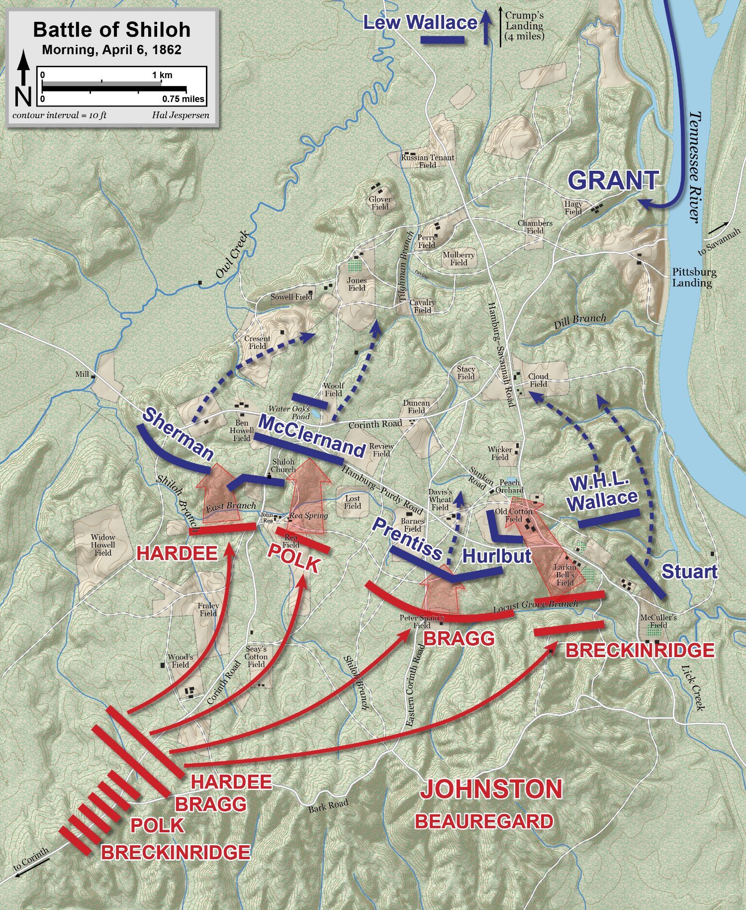
Hal Jespersen (cwmaps.com) · 2021
CC BY-SA 4.0 · Wikimedia Commons
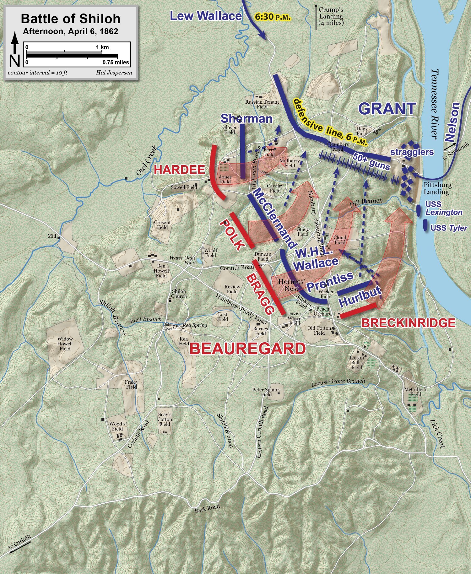
Hal Jespersen (cwmaps.com) · 2021
CC BY-SA 4.0 · Wikimedia Commons
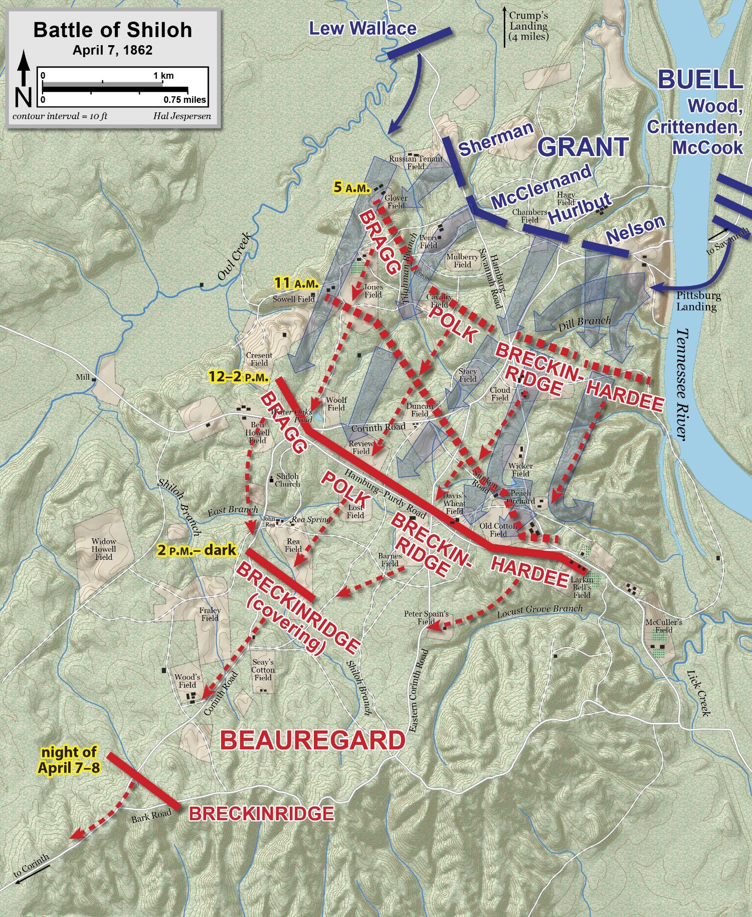
Hal Jespersen (cwmaps.com) · 2021
CC BY-SA 4.0 · Wikimedia Commons
The Battlefield Board's 14-sheet atlas of the battle, hour by hour, drawn from veterans' testimony and a survey of the field. Still the standard source for where every regiment stood.
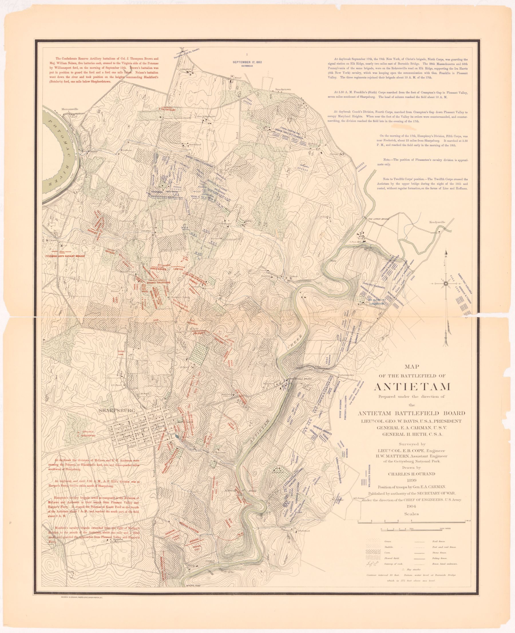
Antietam Battlefield Board (Ezra A. Carman, historical expert; Emmor B. Cope, engineer) · 1904 (revised 1908)
Public domain · Library of Congress
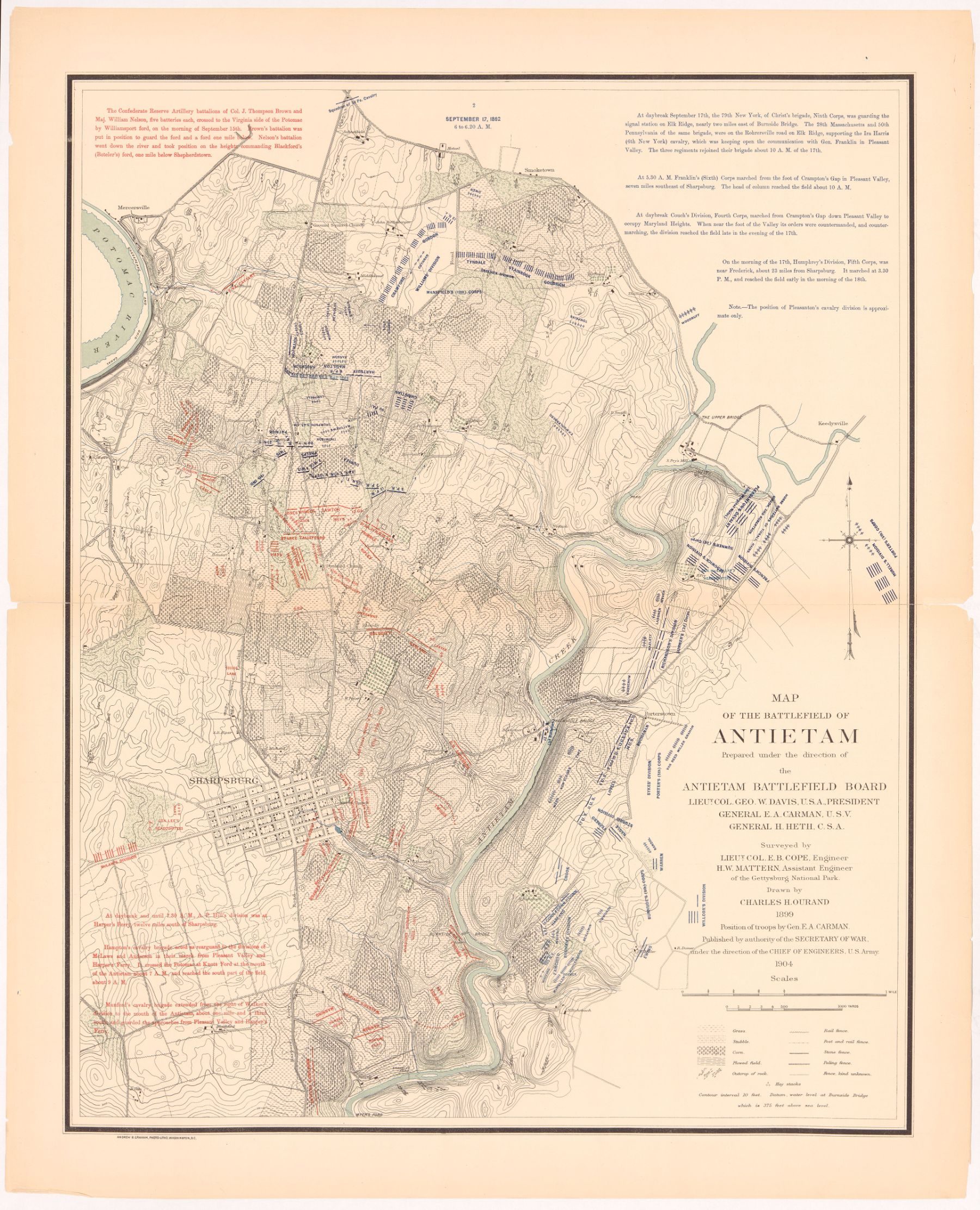
Antietam Battlefield Board (Ezra A. Carman, historical expert; Emmor B. Cope, engineer) · 1904 (revised 1908)
Public domain · Library of Congress
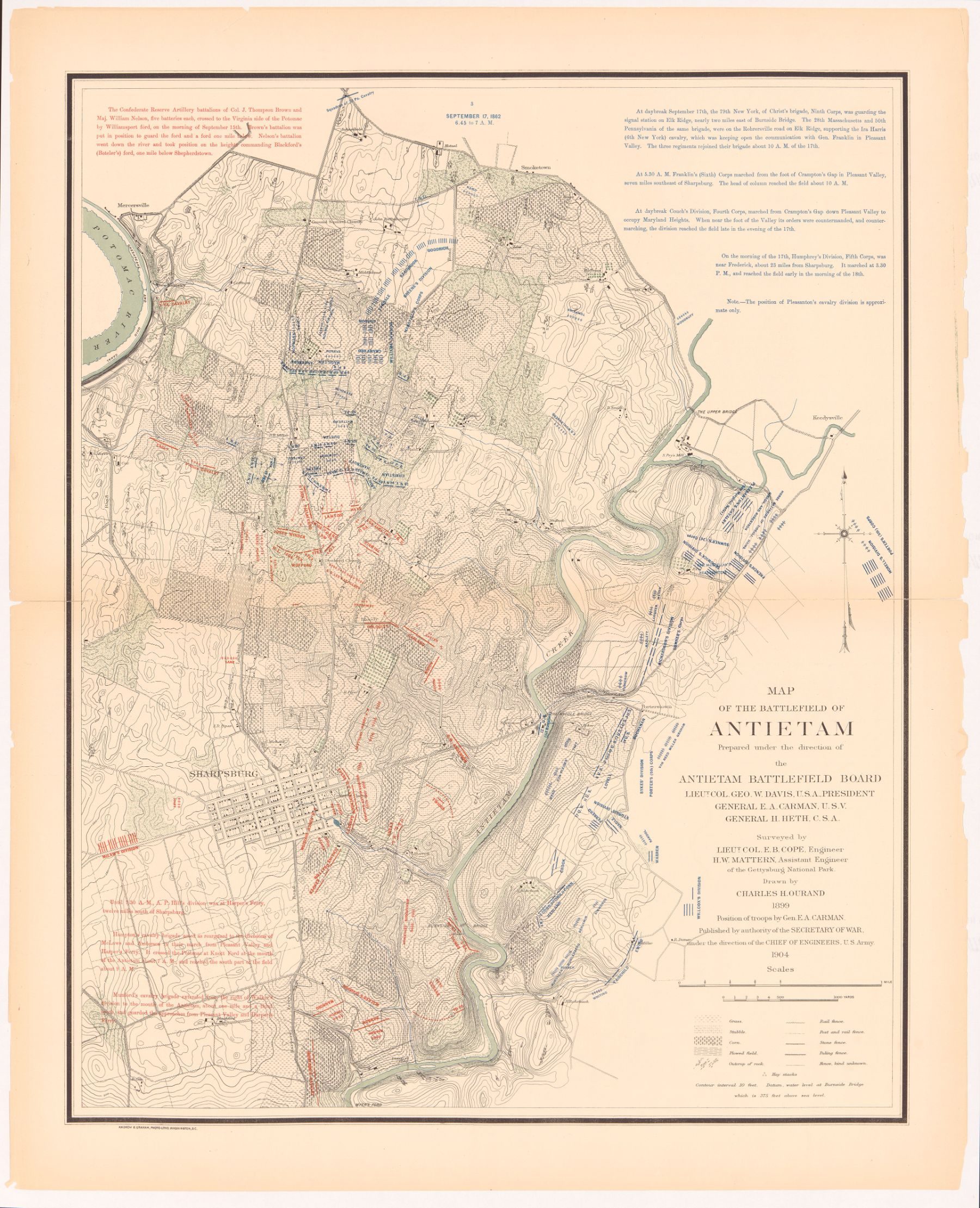
Antietam Battlefield Board (Ezra A. Carman, historical expert; Emmor B. Cope, engineer) · 1904 (revised 1908)
Public domain · Library of Congress
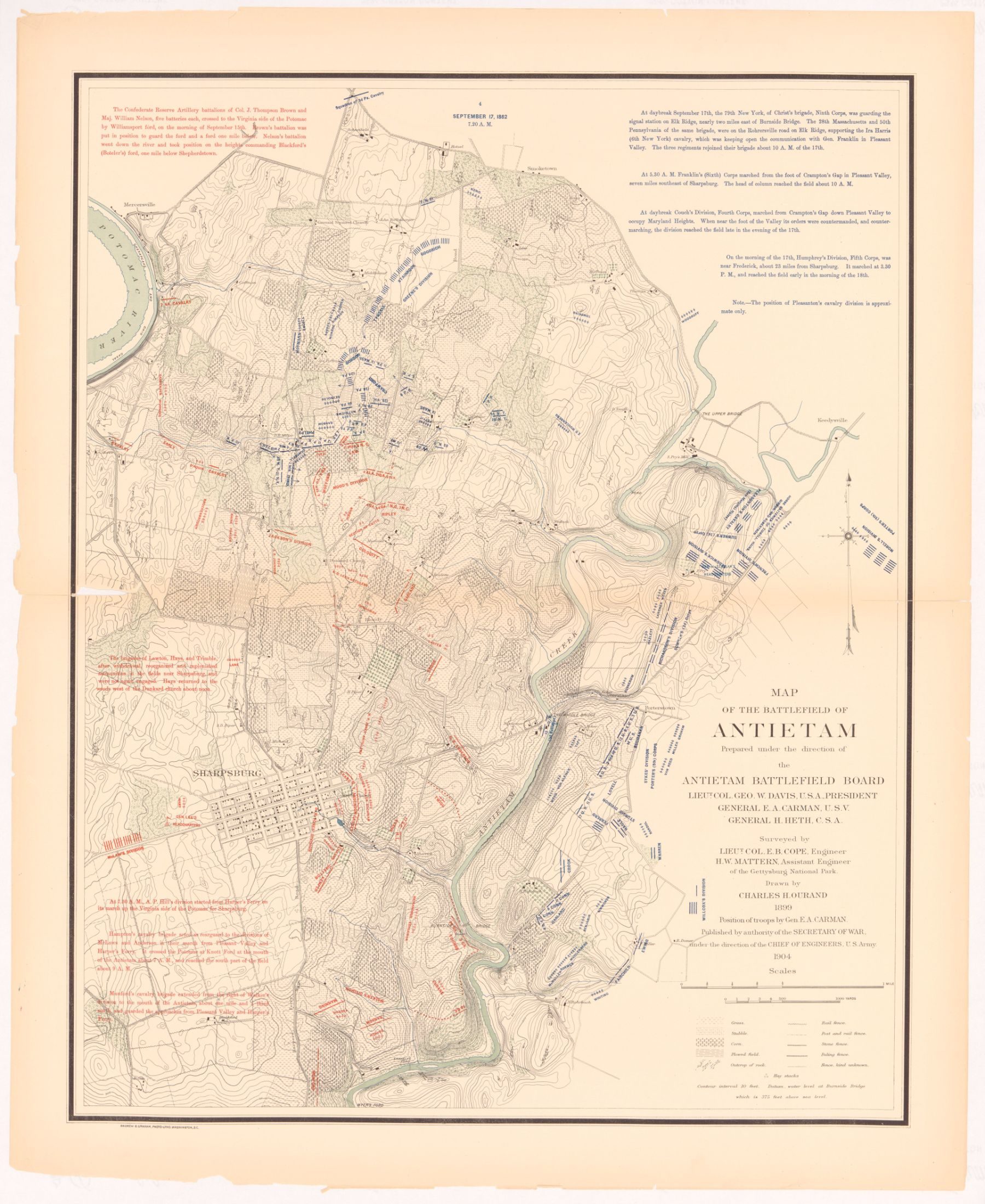
Antietam Battlefield Board (Ezra A. Carman, historical expert; Emmor B. Cope, engineer) · 1904 (revised 1908)
Public domain · Library of Congress
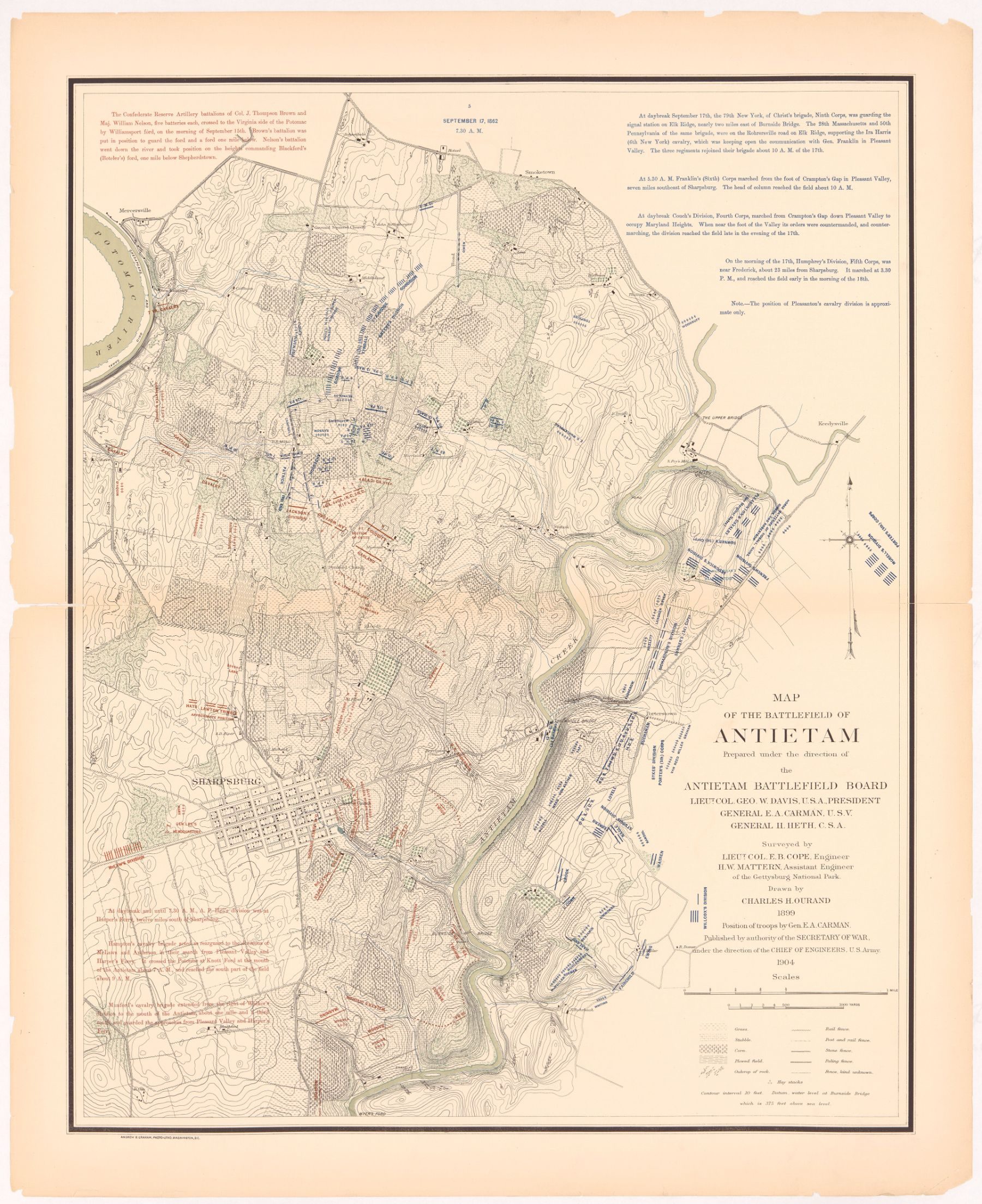
Antietam Battlefield Board (Ezra A. Carman, historical expert; Emmor B. Cope, engineer) · 1904 (revised 1908)
Public domain · Library of Congress
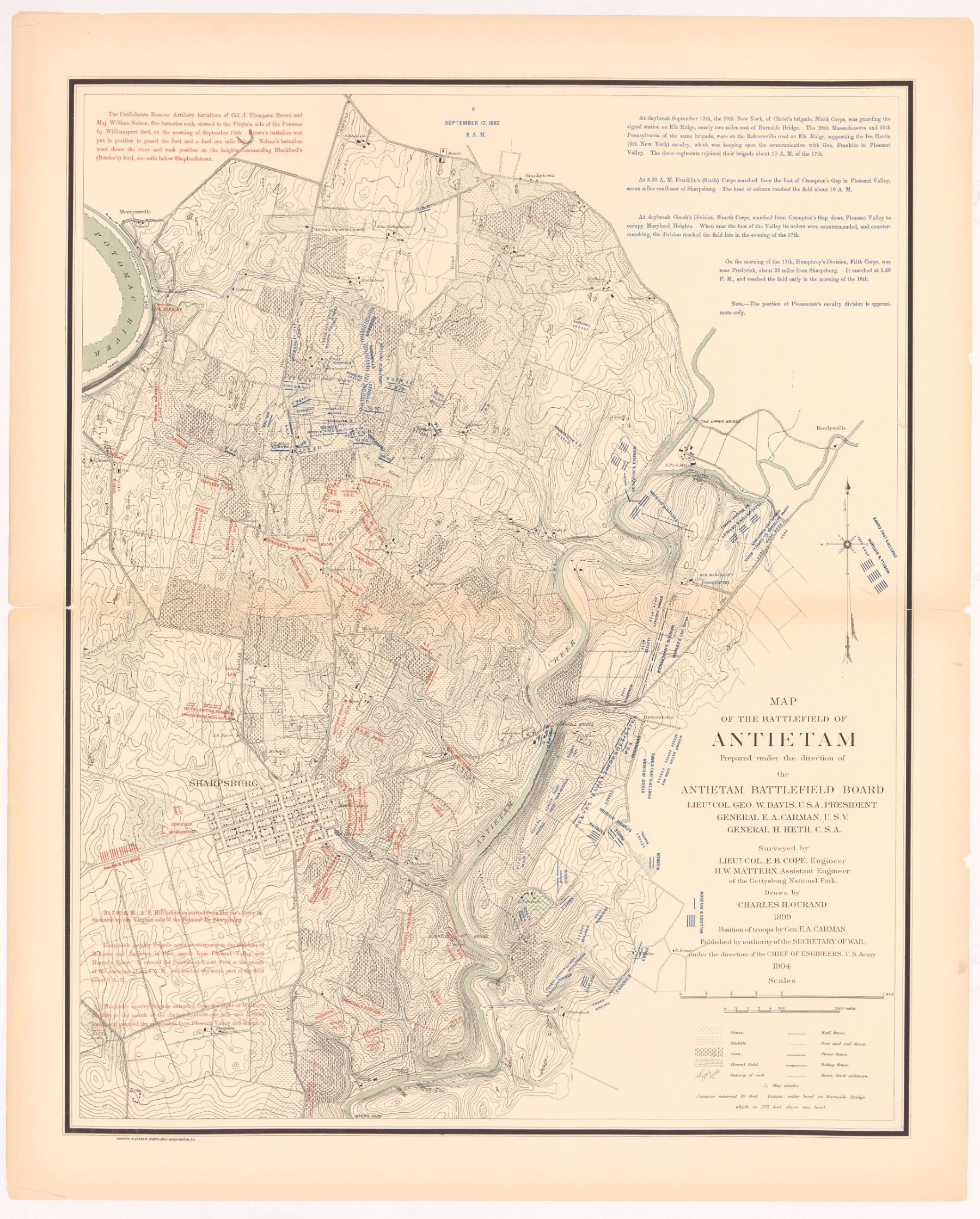
Antietam Battlefield Board (Ezra A. Carman, historical expert; Emmor B. Cope, engineer) · 1904 (revised 1908)
Public domain · Library of Congress
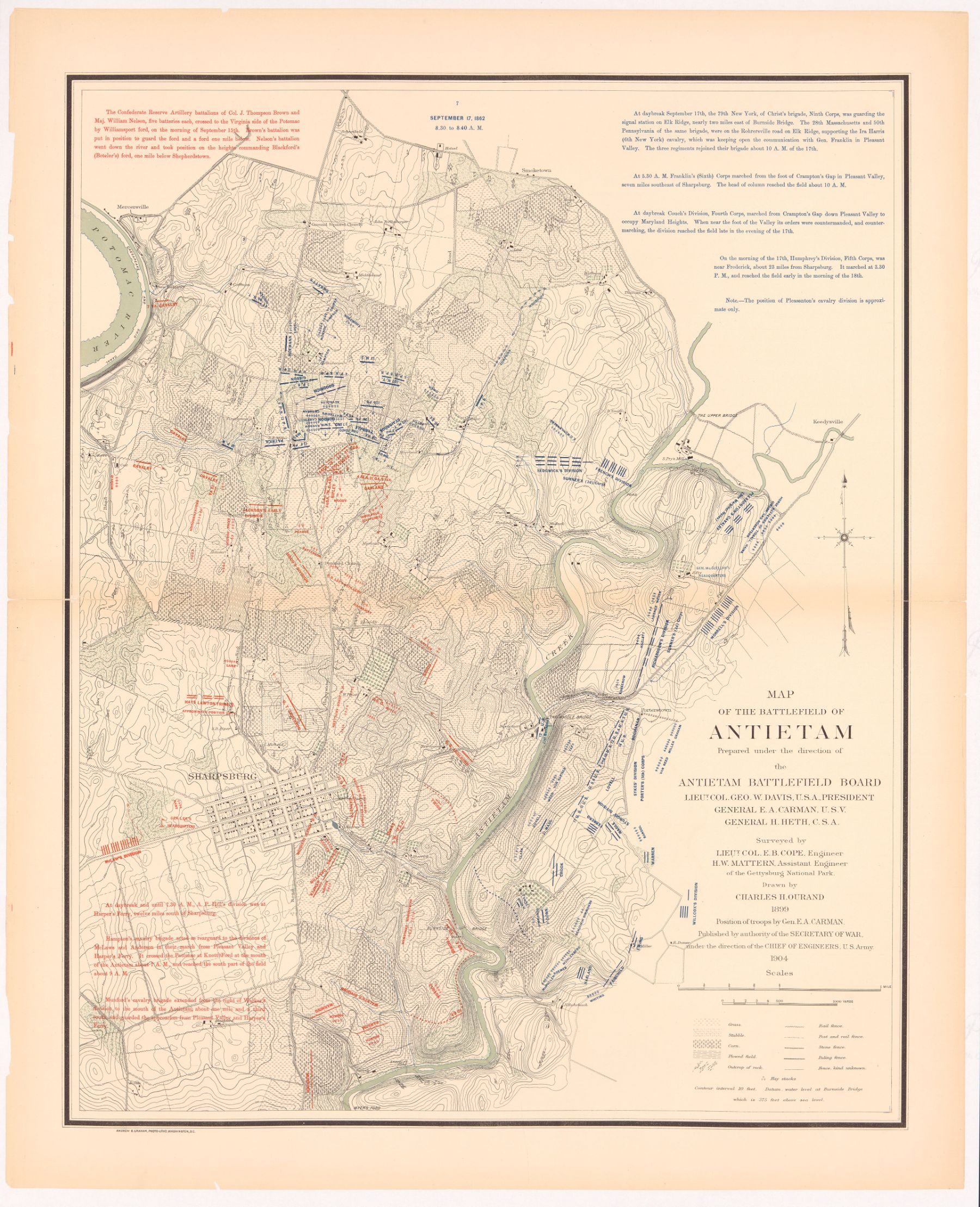
Antietam Battlefield Board (Ezra A. Carman, historical expert; Emmor B. Cope, engineer) · 1904 (revised 1908)
Public domain · Library of Congress
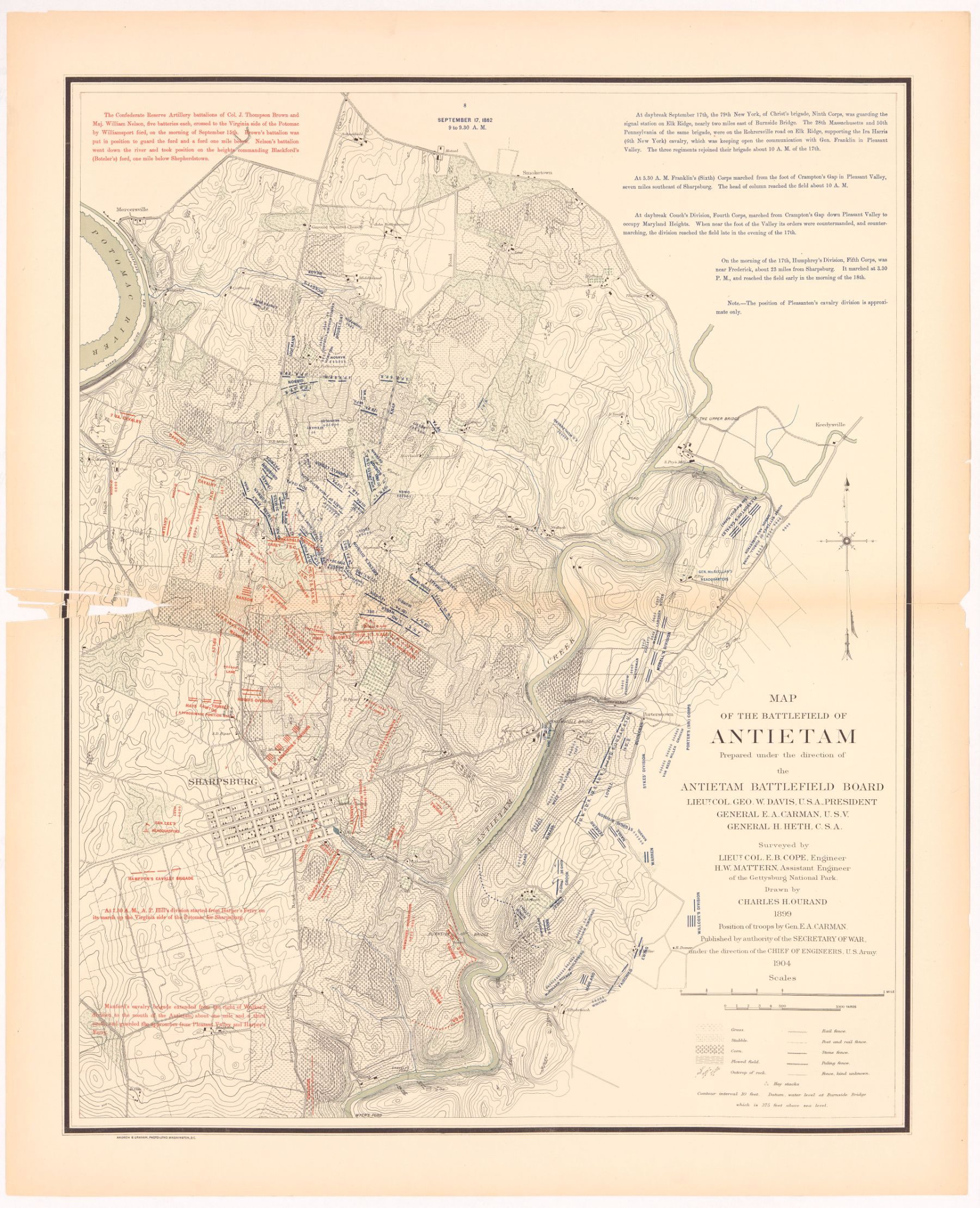
Antietam Battlefield Board (Ezra A. Carman, historical expert; Emmor B. Cope, engineer) · 1904 (revised 1908)
Public domain · Library of Congress
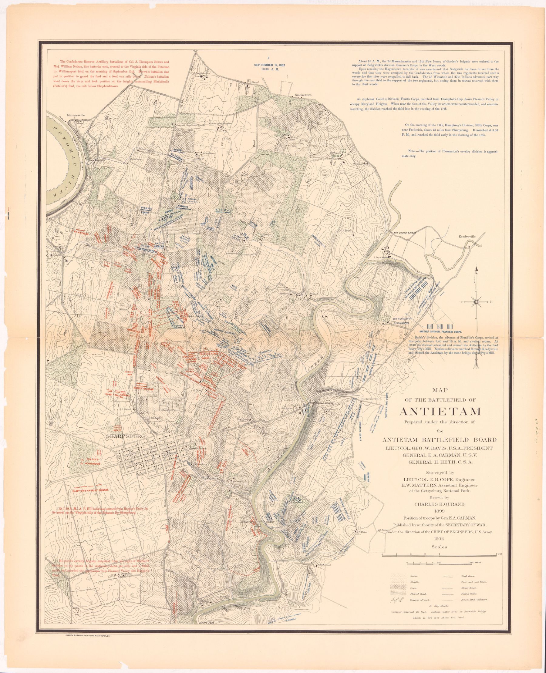
Antietam Battlefield Board (Ezra A. Carman, historical expert; Emmor B. Cope, engineer) · 1904 (revised 1908)
Public domain · Library of Congress
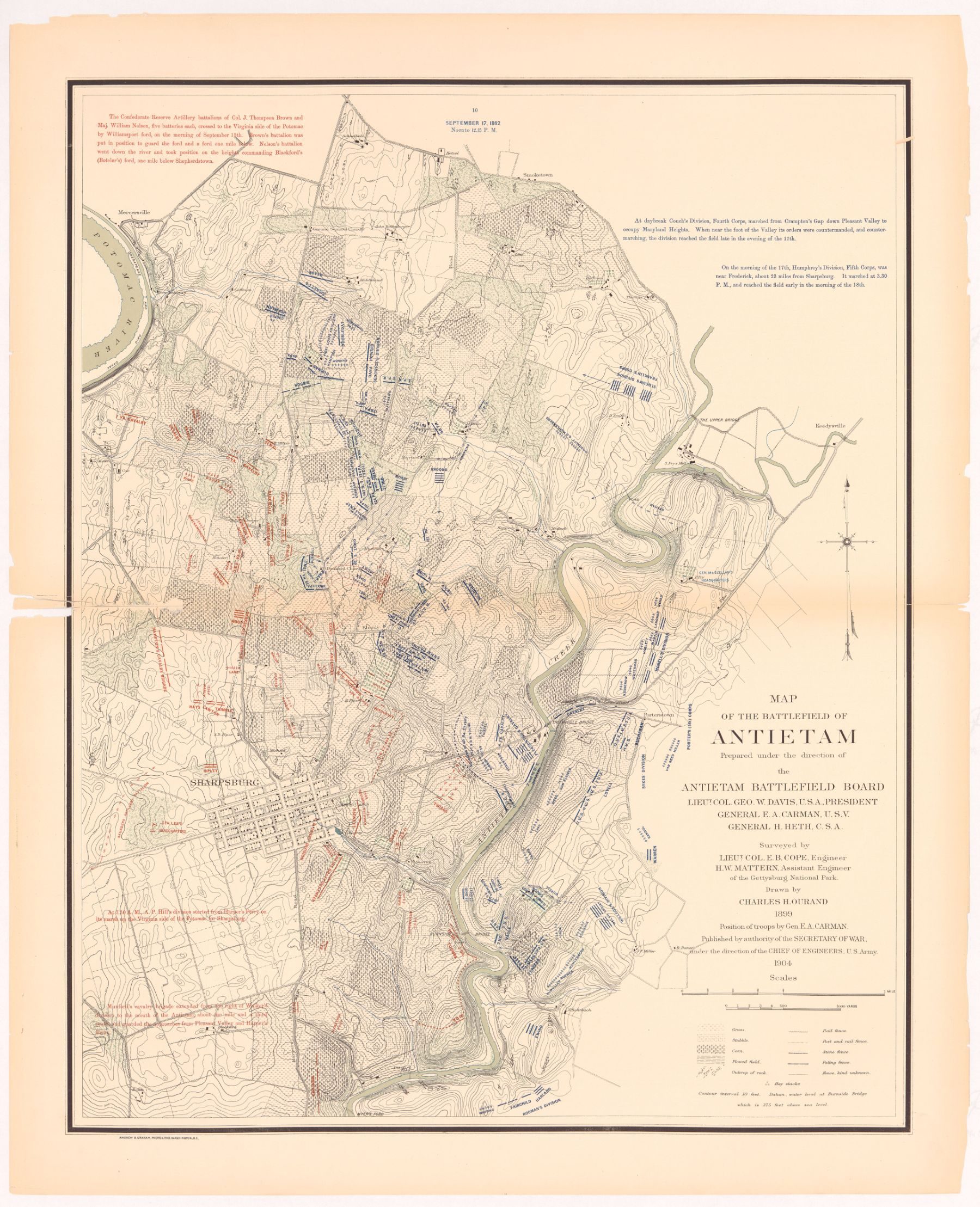
Antietam Battlefield Board (Ezra A. Carman, historical expert; Emmor B. Cope, engineer) · 1904 (revised 1908)
Public domain · Library of Congress
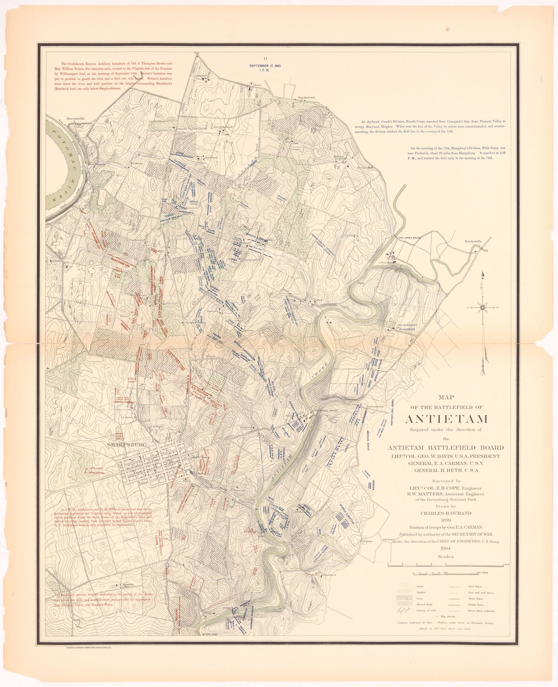
Antietam Battlefield Board (Ezra A. Carman, historical expert; Emmor B. Cope, engineer) · 1904 (revised 1908)
Public domain · Library of Congress
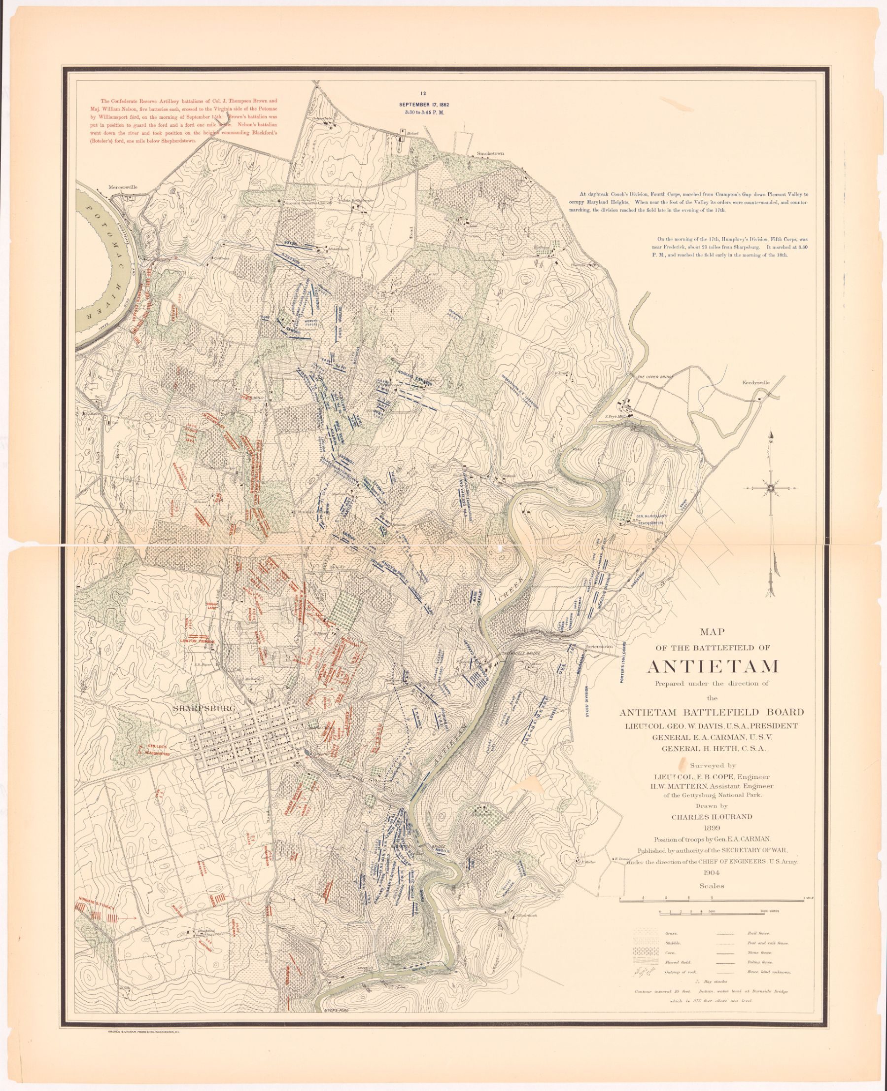
Antietam Battlefield Board (Ezra A. Carman, historical expert; Emmor B. Cope, engineer) · 1904 (revised 1908)
Public domain · Library of Congress
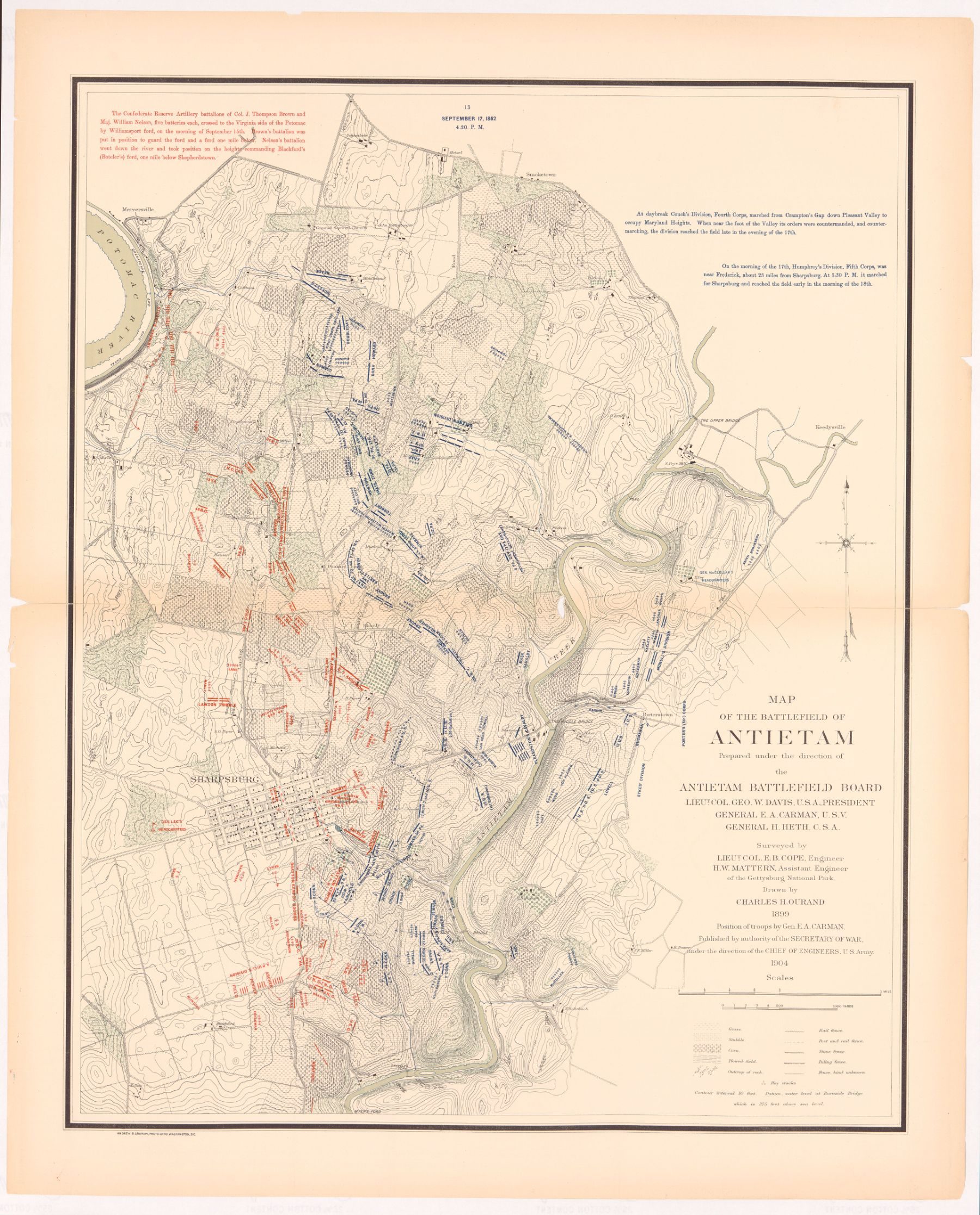
Antietam Battlefield Board (Ezra A. Carman, historical expert; Emmor B. Cope, engineer) · 1904 (revised 1908)
Public domain · Library of Congress
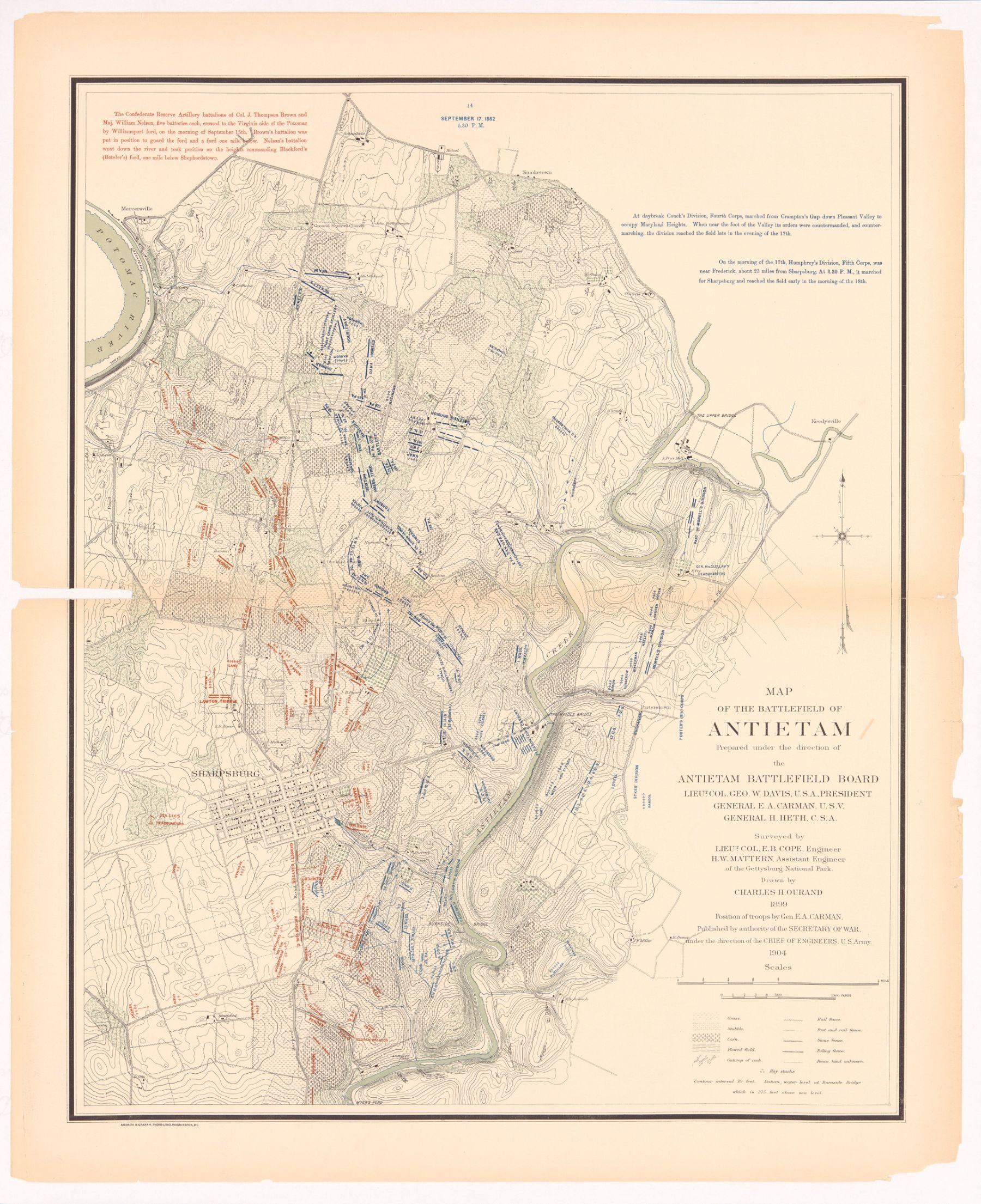
Antietam Battlefield Board (Ezra A. Carman, historical expert; Emmor B. Cope, engineer) · 1904 (revised 1908)
Public domain · Library of Congress
Modern phase maps by Civil War cartographer Hal Jespersen, based on the official records and park research. John Bachelder spent decades interviewing veterans of both armies; his 1876 isometric maps of each day became the basis for the park's monuments.
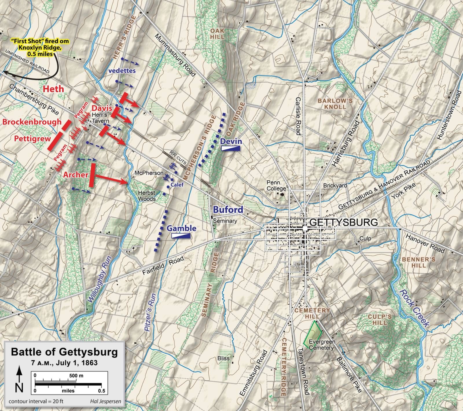
Hal Jespersen (cwmaps.com) · 2006–2011
CC BY 3.0 · Wikimedia Commons
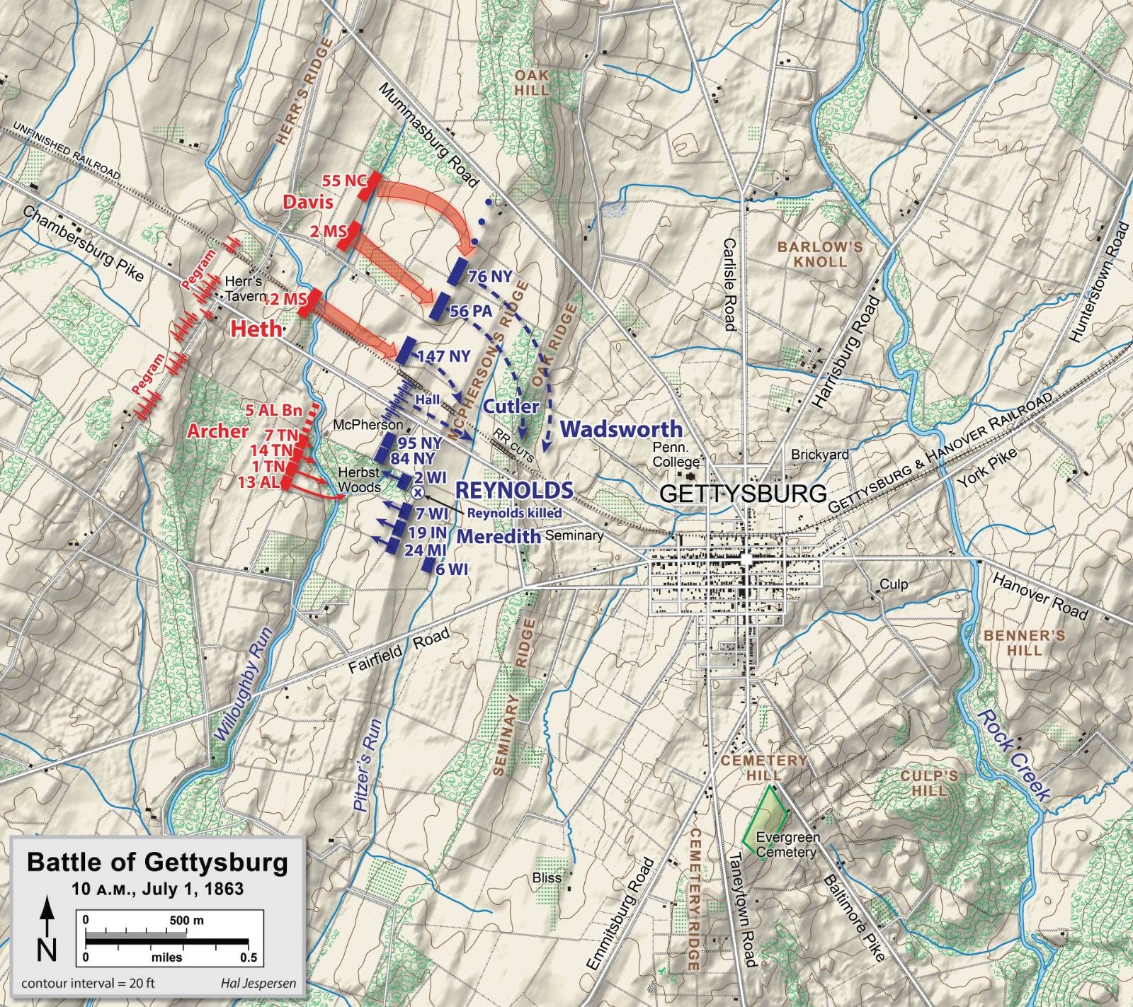
Hal Jespersen (cwmaps.com) · 2006–2011
CC BY 3.0 · Wikimedia Commons
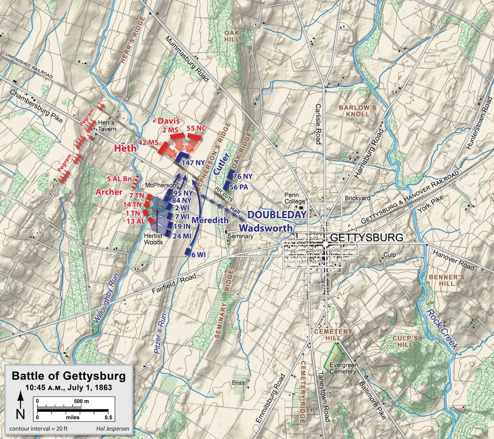
Hal Jespersen (cwmaps.com) · 2006–2011
CC BY 3.0 · Wikimedia Commons
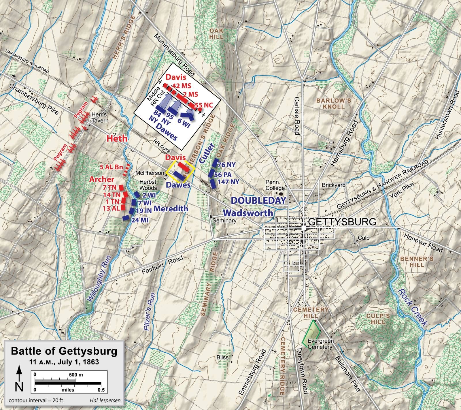
Hal Jespersen (cwmaps.com) · 2006–2011
CC BY 3.0 · Wikimedia Commons
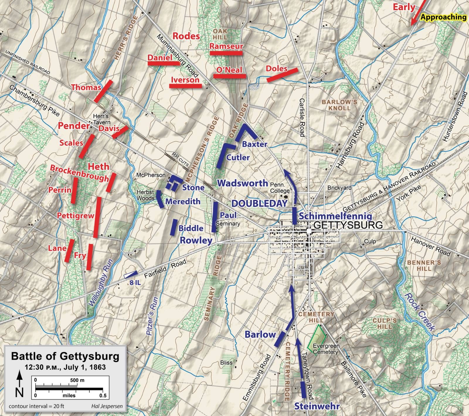
Hal Jespersen (cwmaps.com) · 2006–2011
CC BY 3.0 · Wikimedia Commons
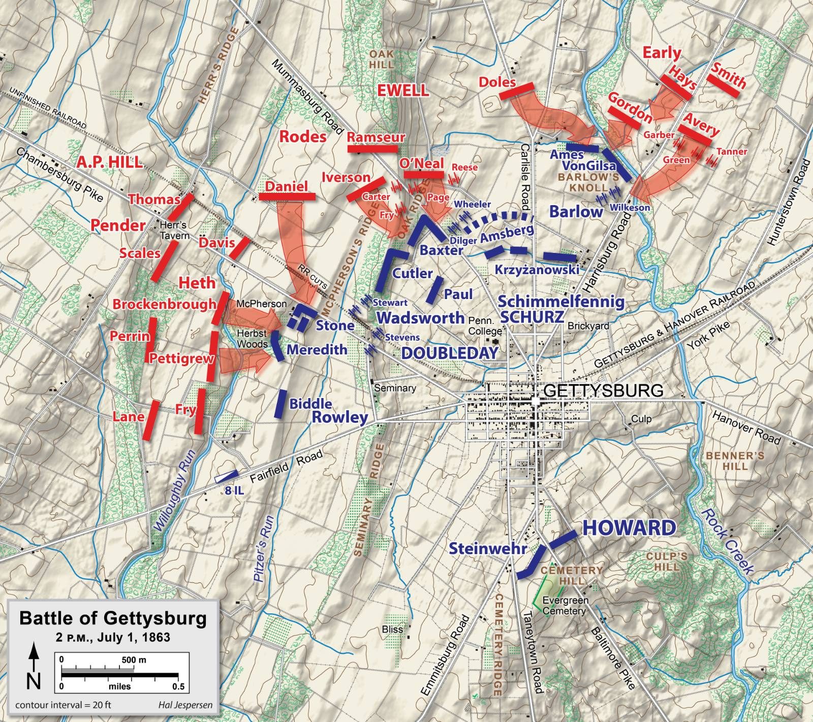
Hal Jespersen (cwmaps.com) · 2006–2011
CC BY 3.0 · Wikimedia Commons
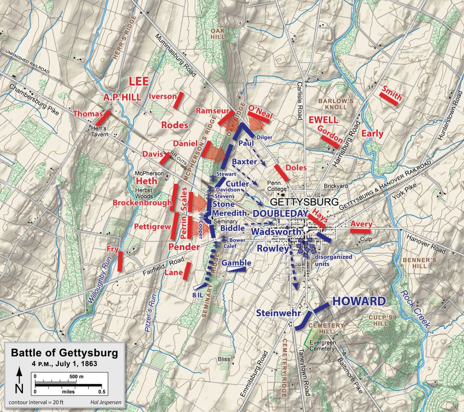
Hal Jespersen (cwmaps.com) · 2006–2011
CC BY 3.0 · Wikimedia Commons
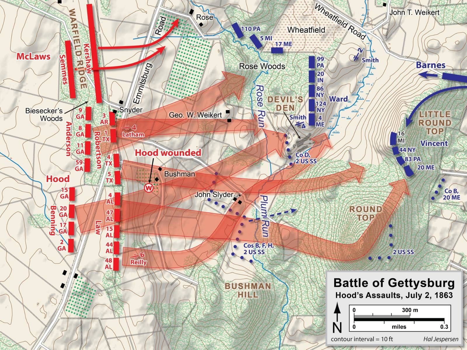
Hal Jespersen (cwmaps.com) · 2006–2011
CC BY 3.0 · Wikimedia Commons
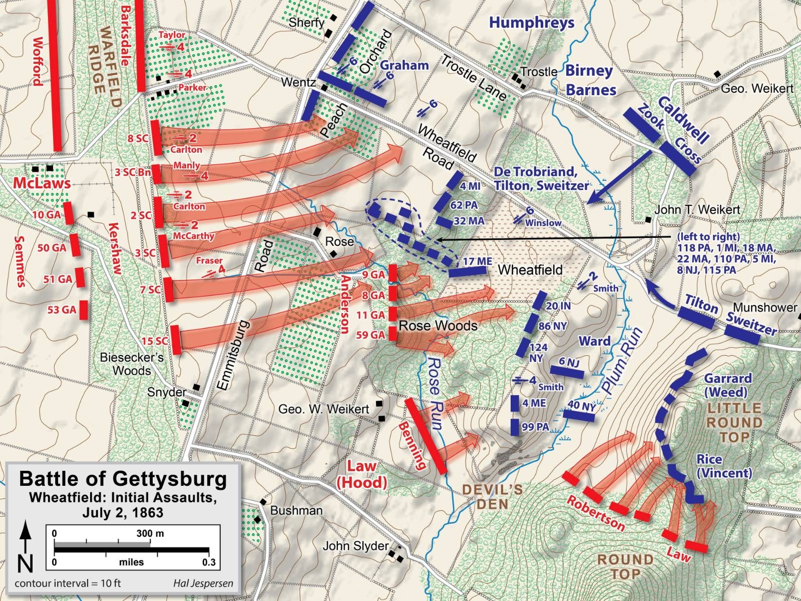
Hal Jespersen (cwmaps.com) · 2006–2011
CC BY 3.0 · Wikimedia Commons
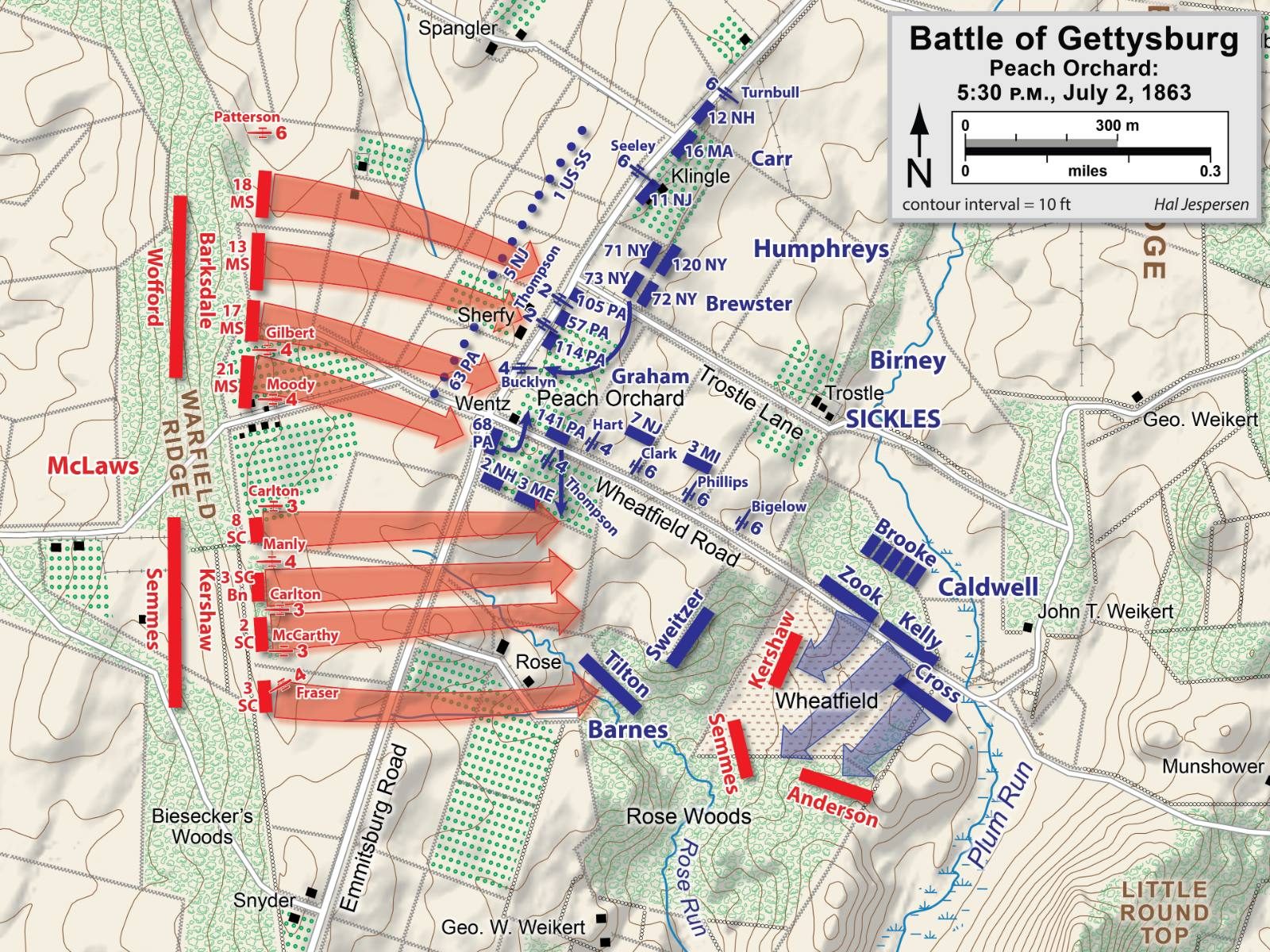
Hal Jespersen (cwmaps.com) · 2006–2011
CC BY 3.0 · Wikimedia Commons
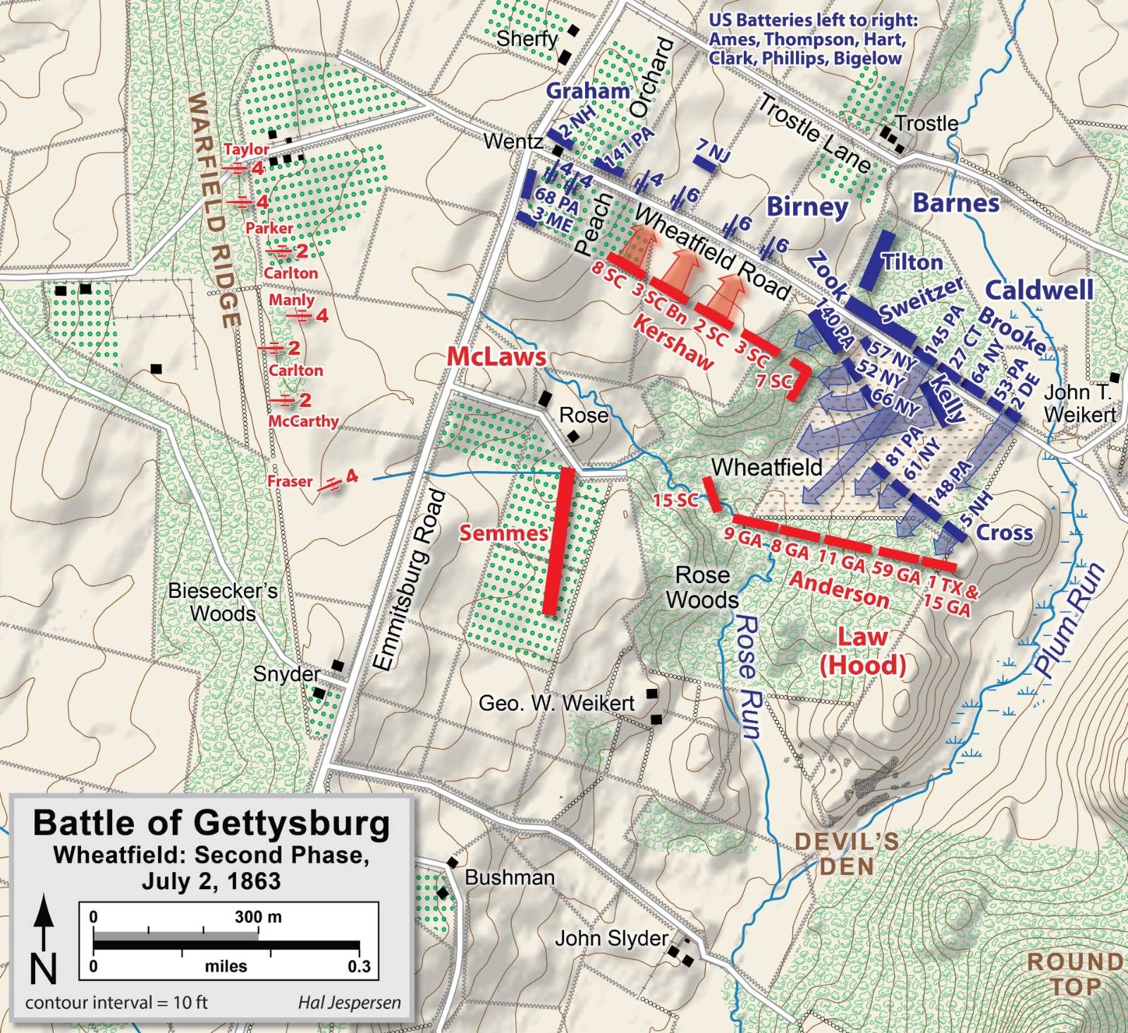
Hal Jespersen (cwmaps.com) · 2006–2011
CC BY 3.0 · Wikimedia Commons
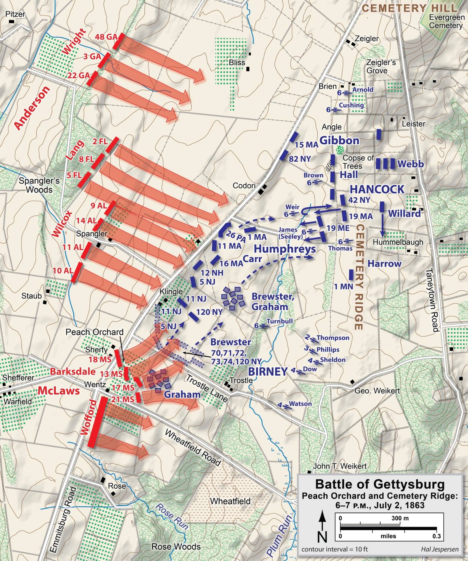
Hal Jespersen (cwmaps.com) · 2006–2011
CC BY 3.0 · Wikimedia Commons
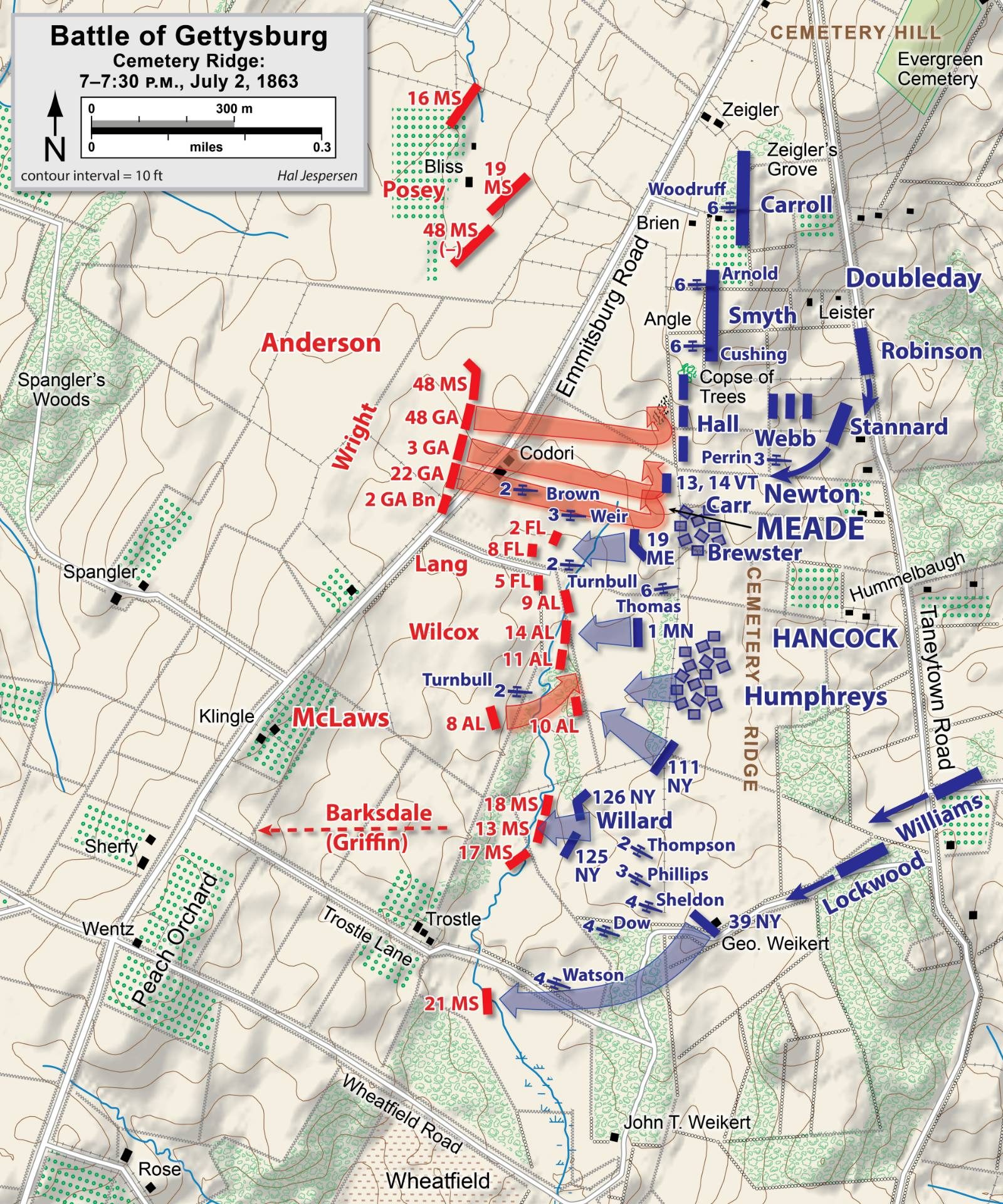
Hal Jespersen (cwmaps.com) · 2006–2011
CC BY 3.0 · Wikimedia Commons
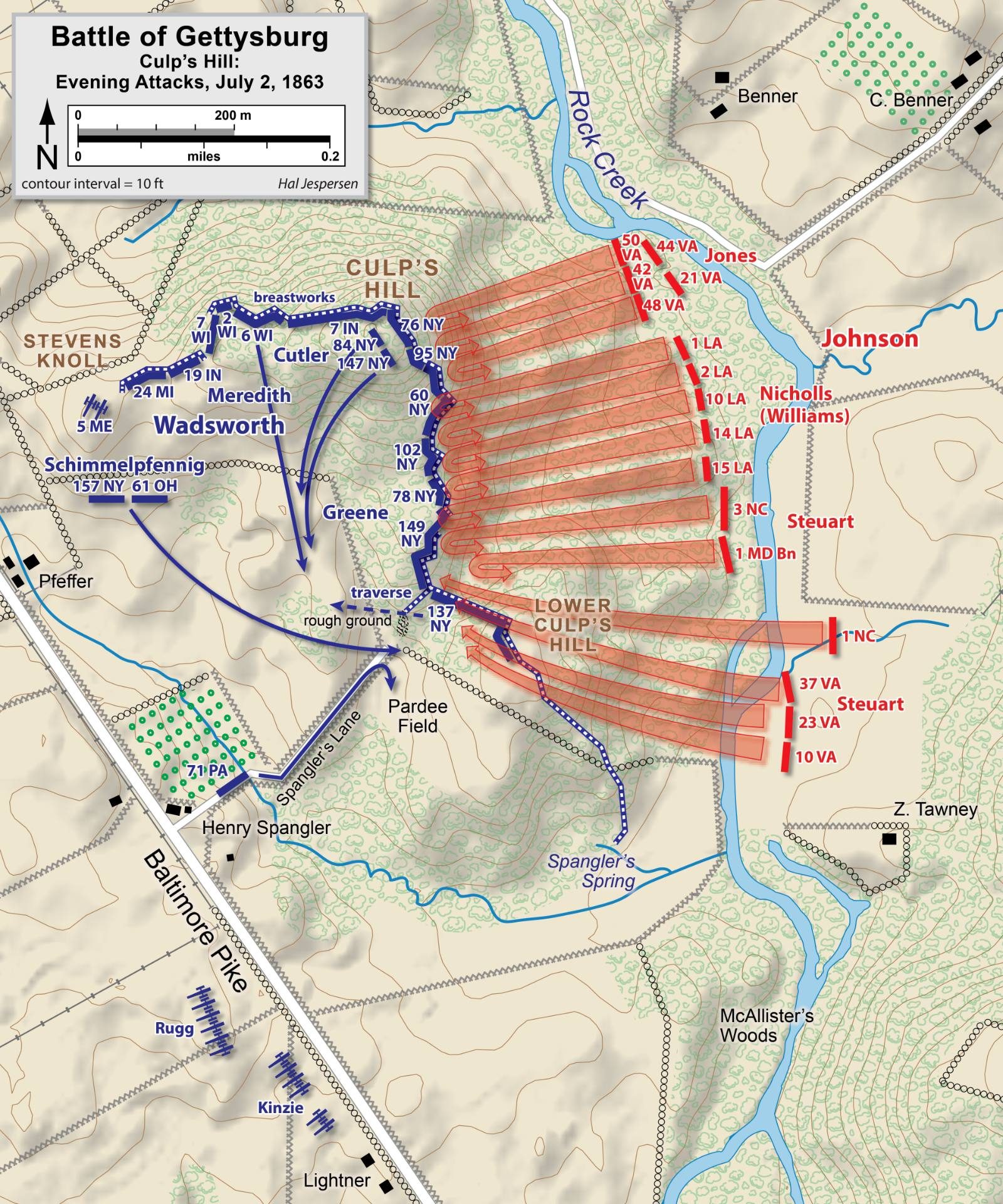
Hal Jespersen (cwmaps.com) · 2006–2011
CC BY 3.0 · Wikimedia Commons
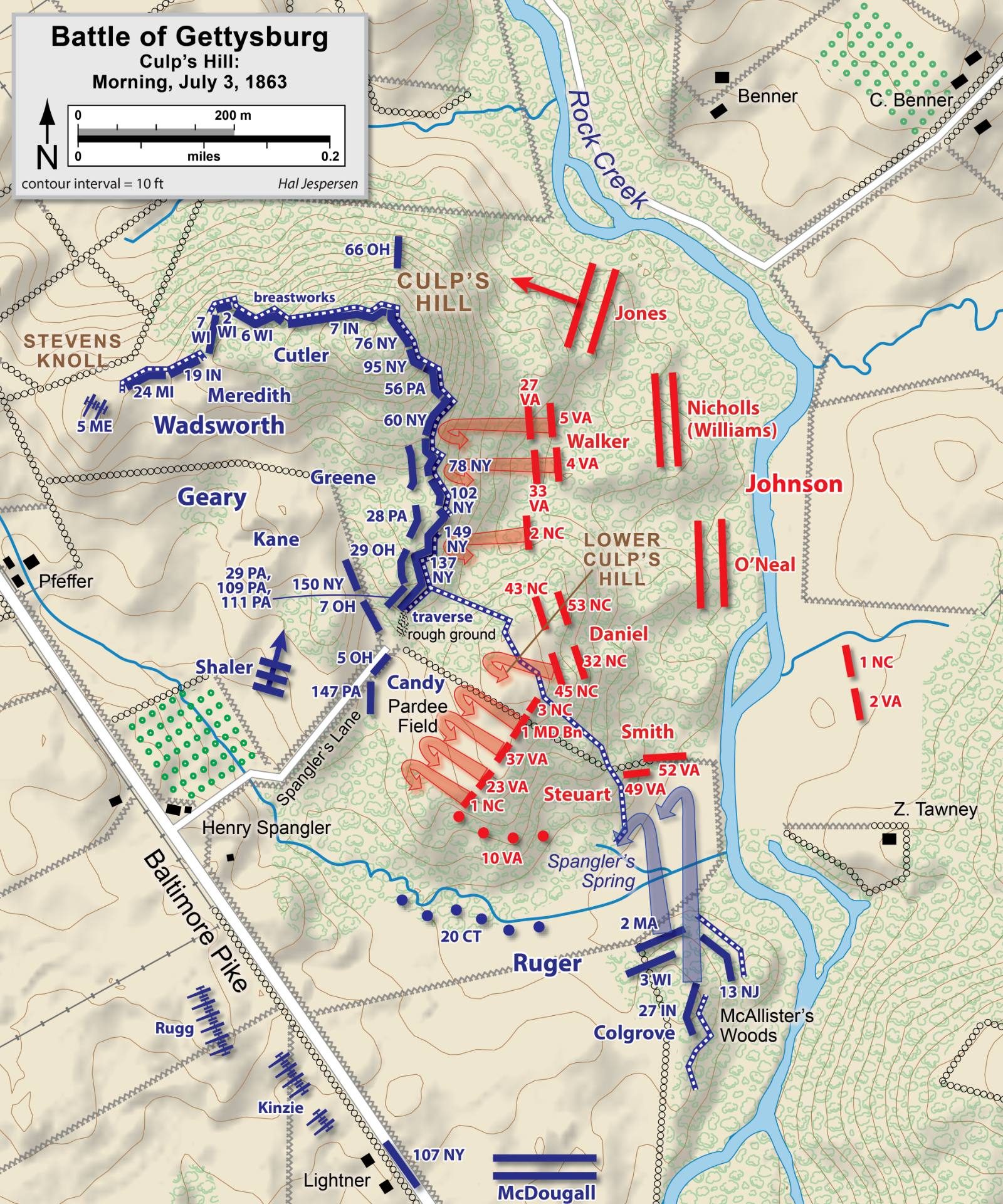
Hal Jespersen (cwmaps.com) · 2006–2011
CC BY 3.0 · Wikimedia Commons
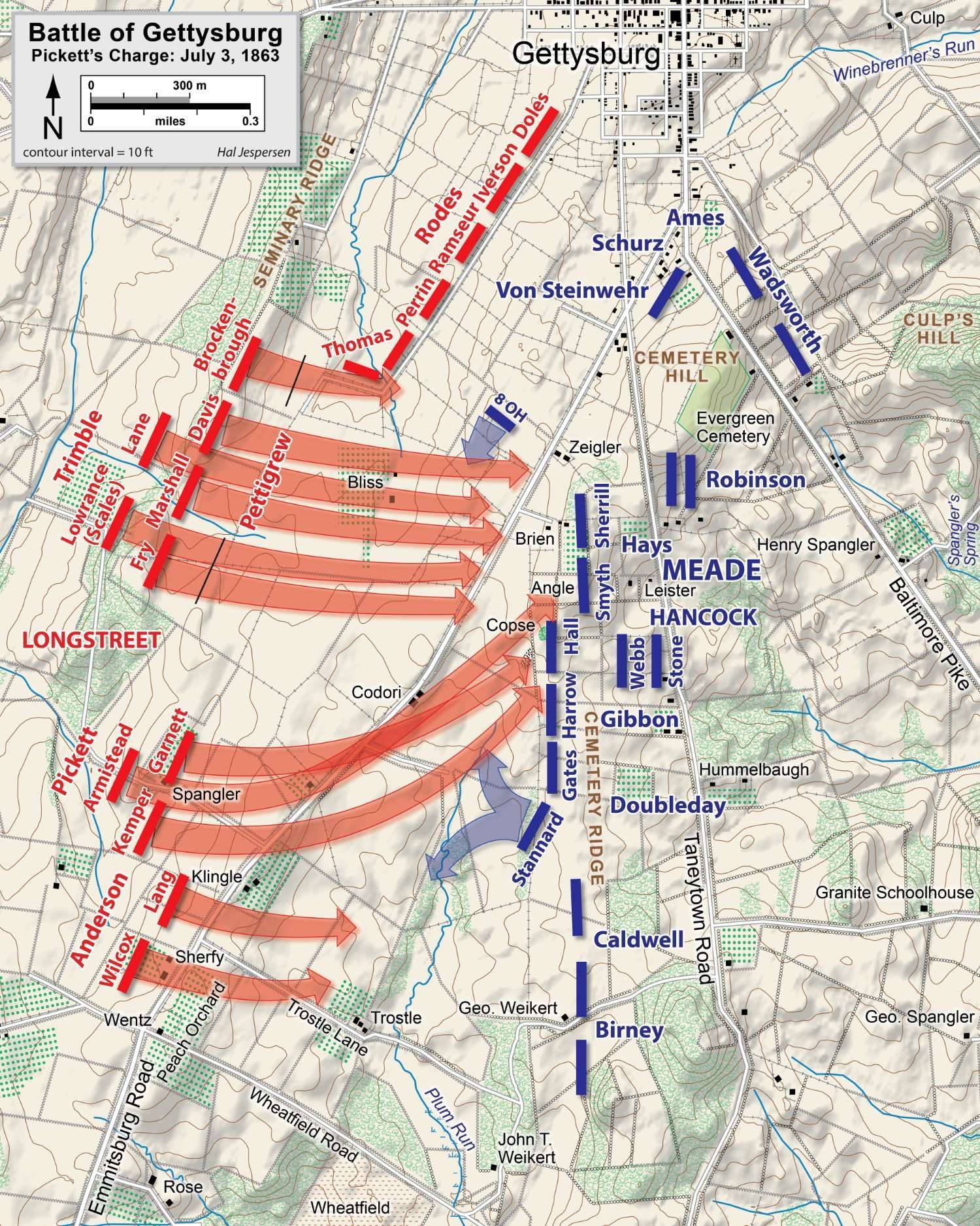
Hal Jespersen (cwmaps.com) · 2006–2011
CC BY 3.0 · Wikimedia Commons
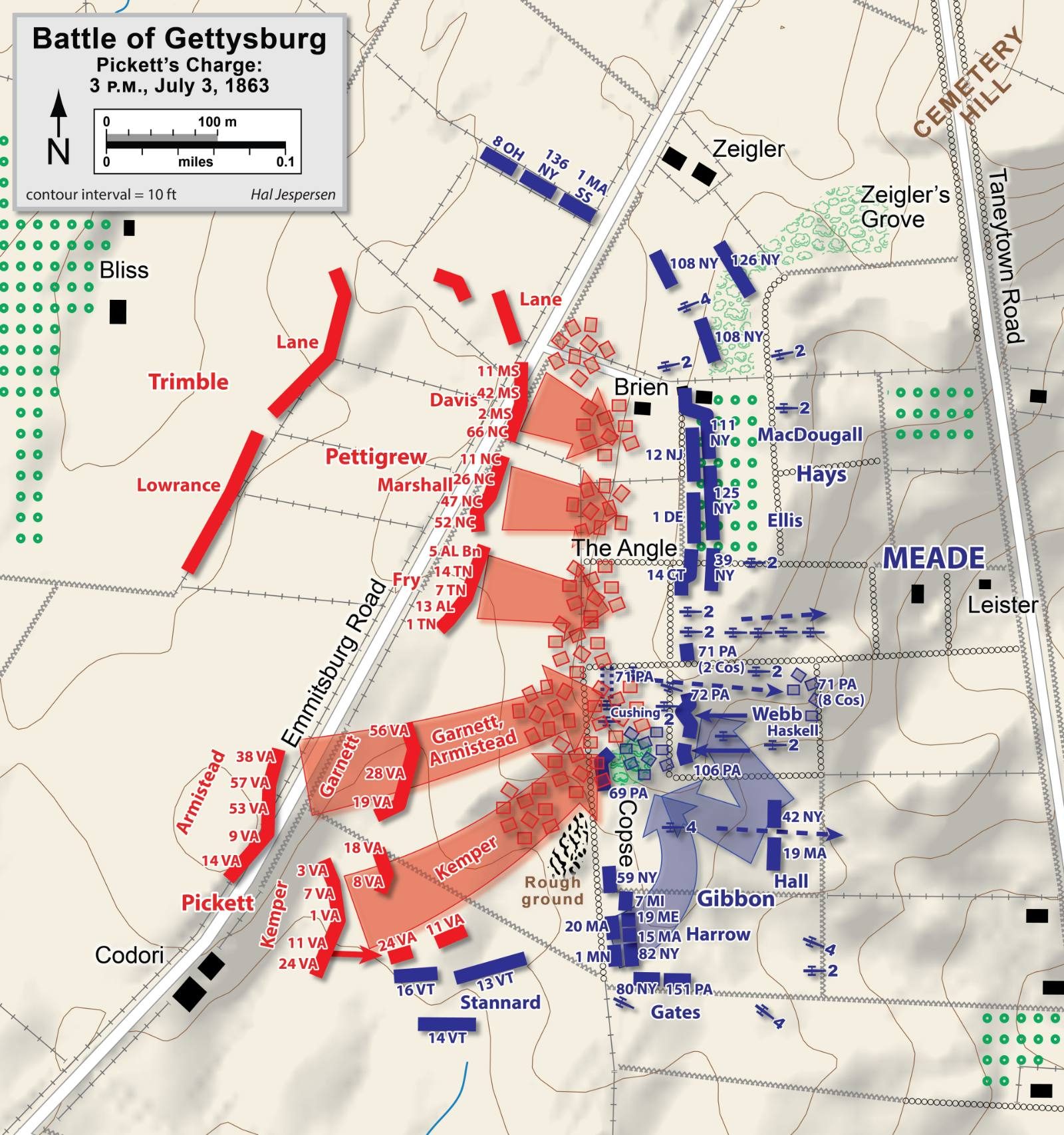
Hal Jespersen (cwmaps.com) · 2006–2011
CC BY 3.0 · Wikimedia Commons
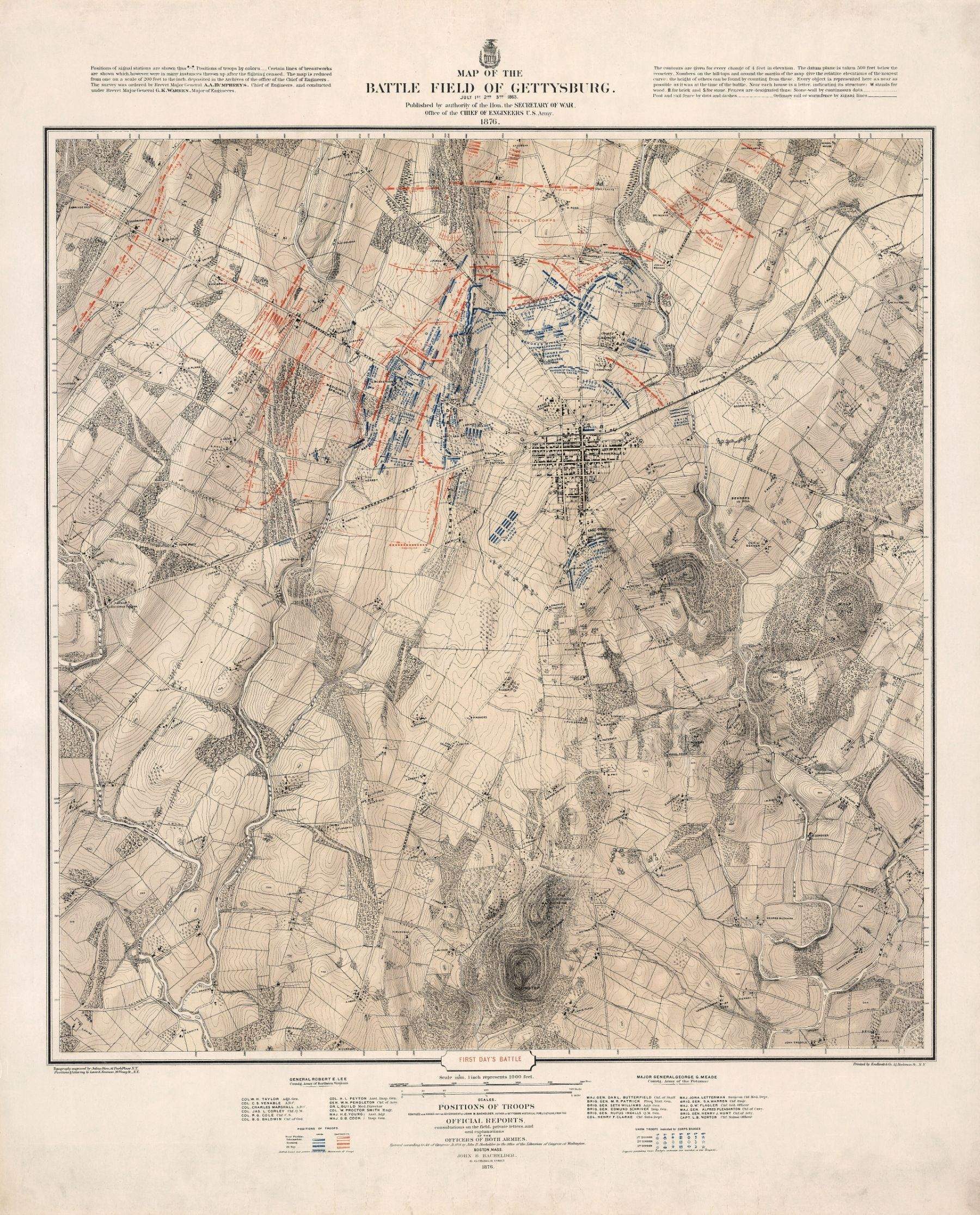
John B. Bachelder · 1876
Public domain · David Rumsey Map Collection, via Wikimedia Commons
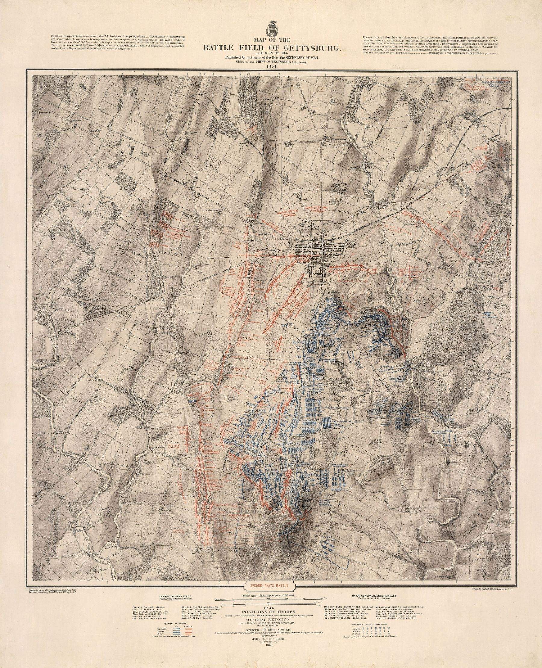
John B. Bachelder · 1876
Public domain · David Rumsey Map Collection, via Wikimedia Commons
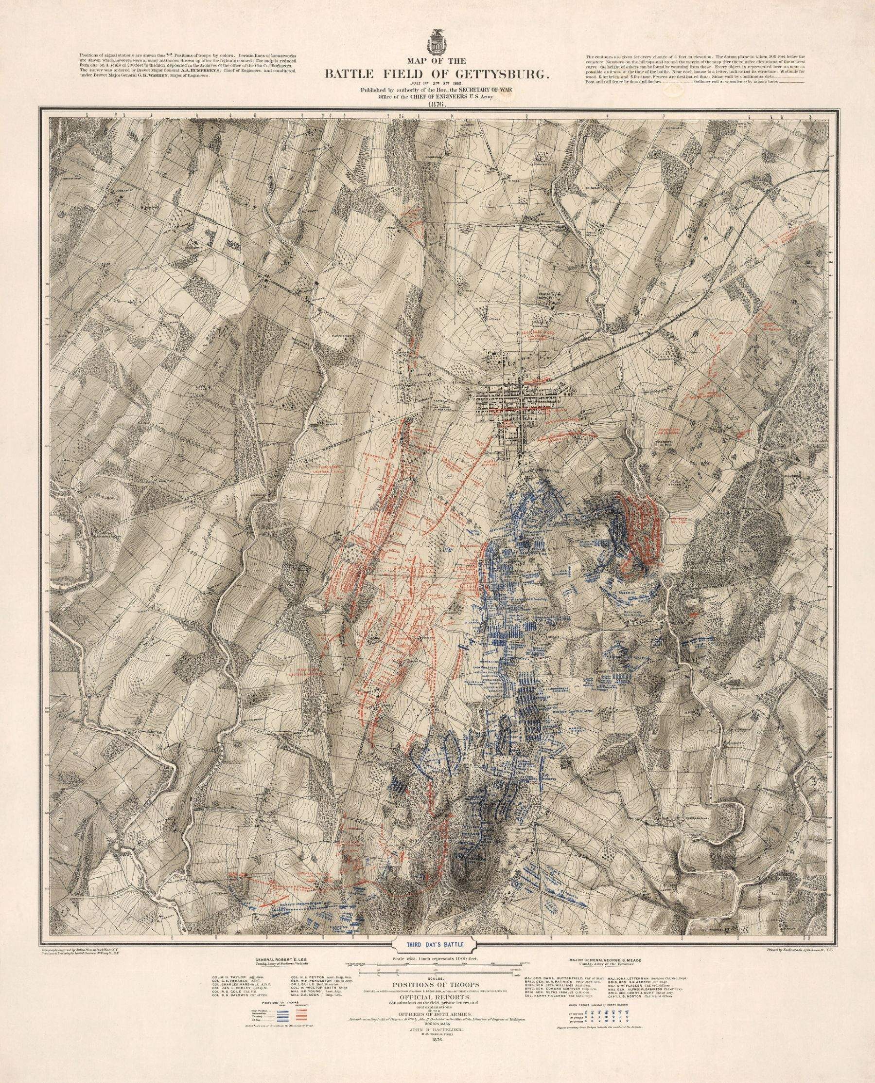
John B. Bachelder · 1876
Public domain · David Rumsey Map Collection, via Wikimedia Commons
Modern phase maps by Civil War cartographer Hal Jespersen, based on the official records and park research.
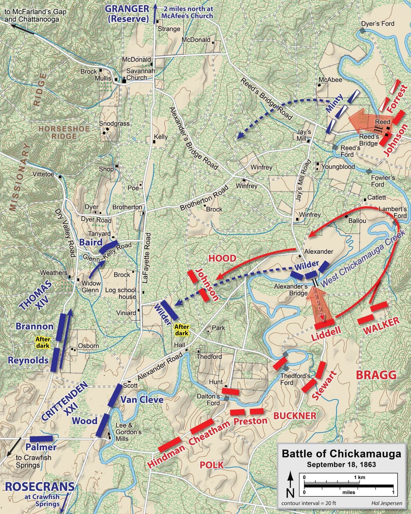
Hal Jespersen (cwmaps.com) · 2006–2011
CC BY 3.0 · Wikimedia Commons
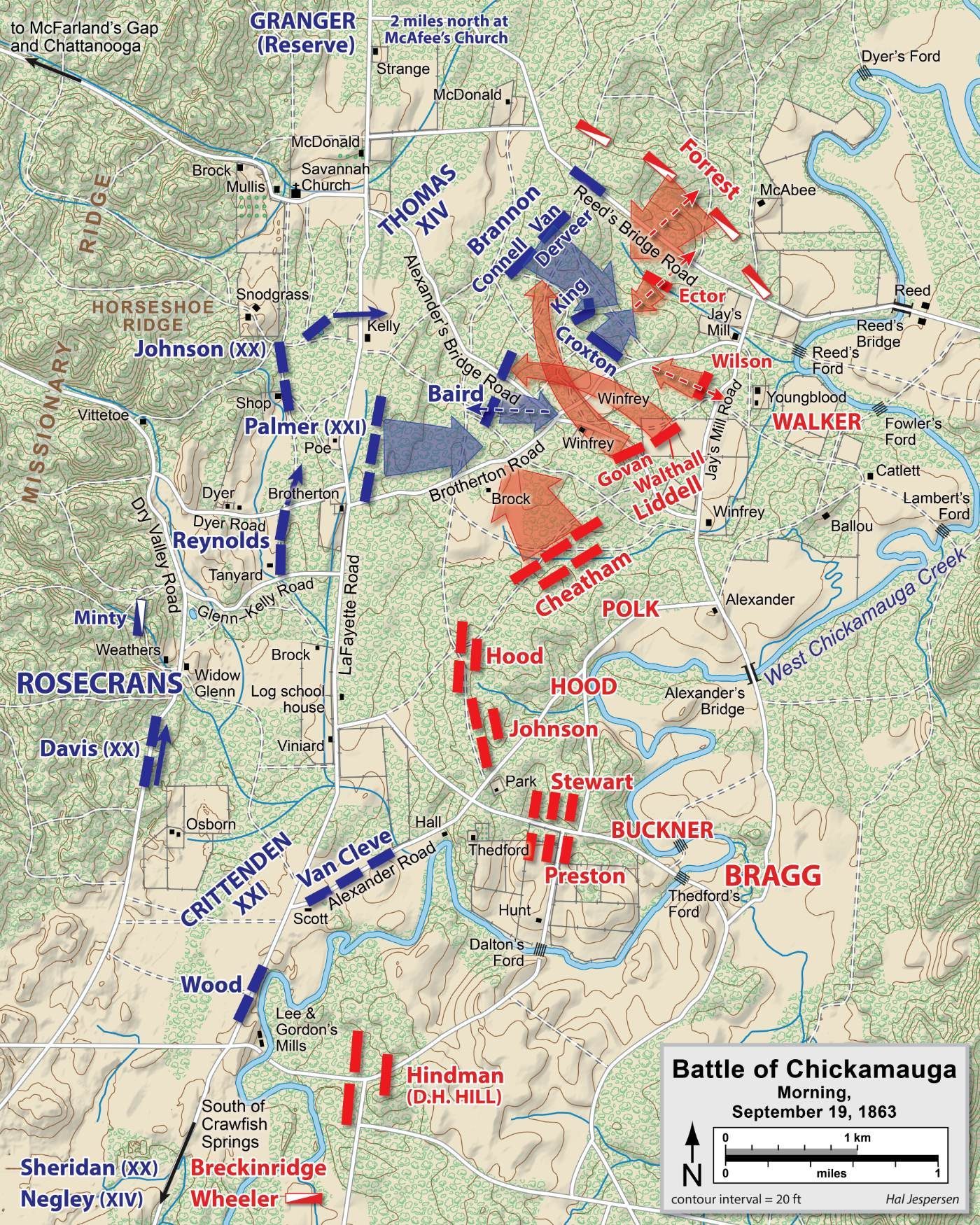
Hal Jespersen (cwmaps.com) · 2006–2011
CC BY 3.0 · Wikimedia Commons
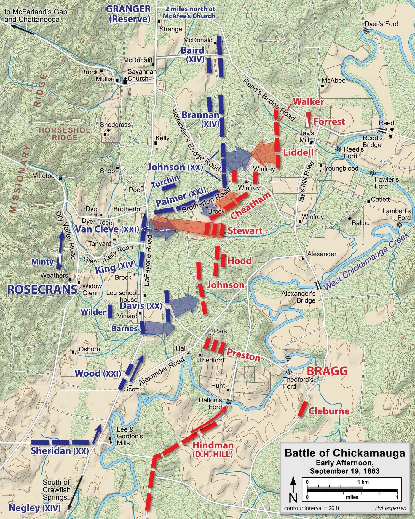
Hal Jespersen (cwmaps.com) · 2006–2011
CC BY 3.0 · Wikimedia Commons
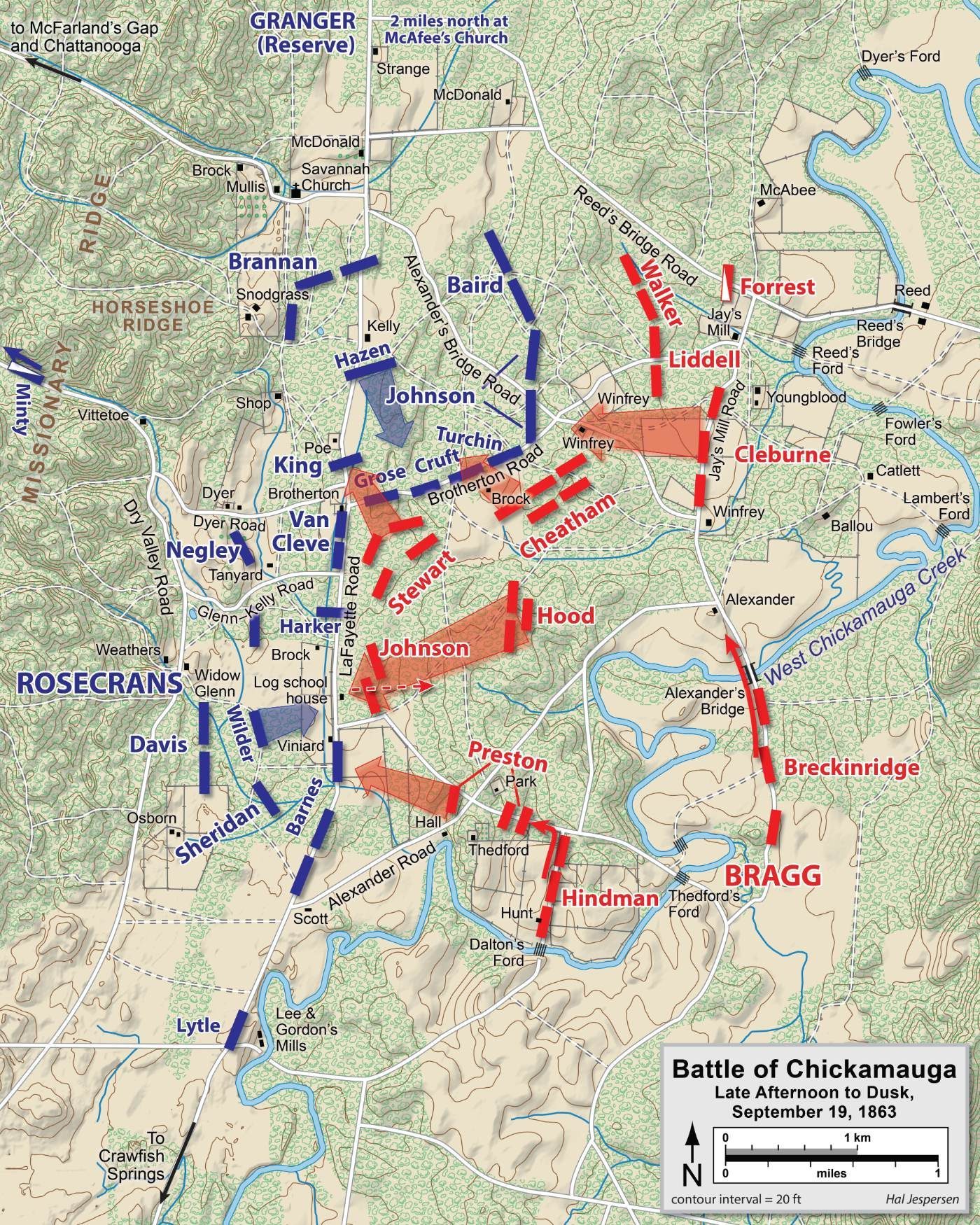
Hal Jespersen (cwmaps.com) · 2006–2011
CC BY 3.0 · Wikimedia Commons
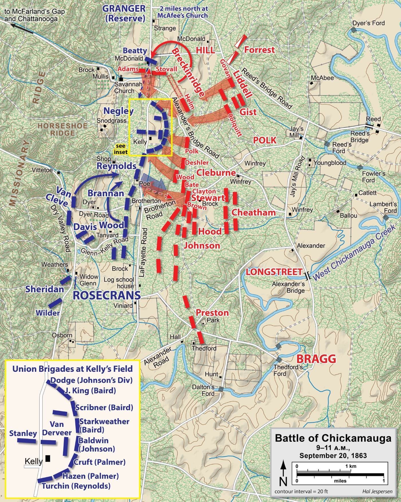
Hal Jespersen (cwmaps.com) · 2006–2011
CC BY 3.0 · Wikimedia Commons
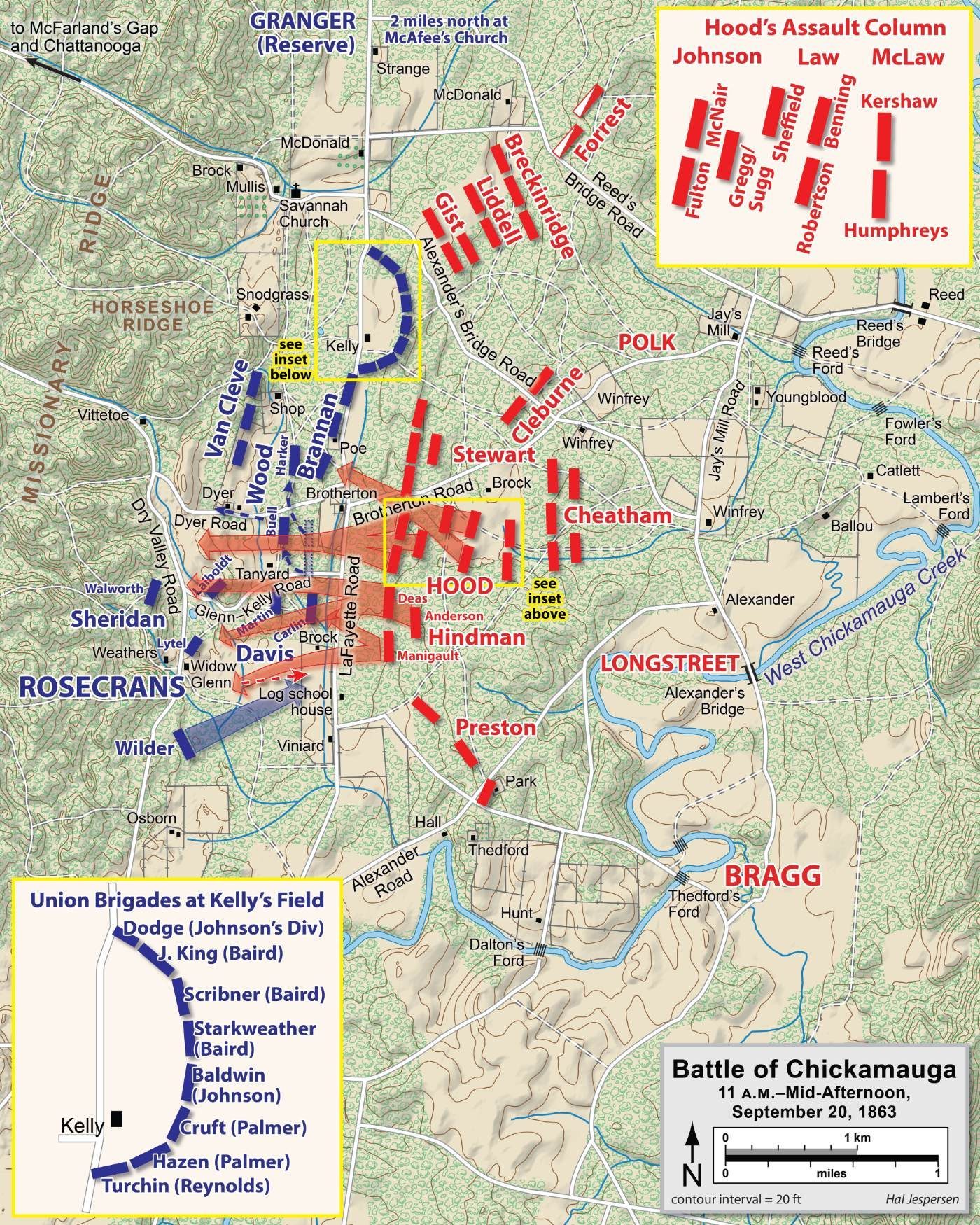
Hal Jespersen (cwmaps.com) · 2006–2011
CC BY 3.0 · Wikimedia Commons
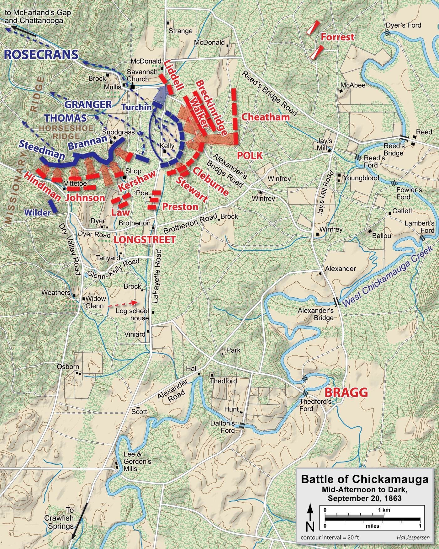
Hal Jespersen (cwmaps.com) · 2006–2011
CC BY 3.0 · Wikimedia Commons
Colonel Carrington, who commanded Fort Phil Kearny, mapped the fort and the ridges where the Fetterman Fight took place.
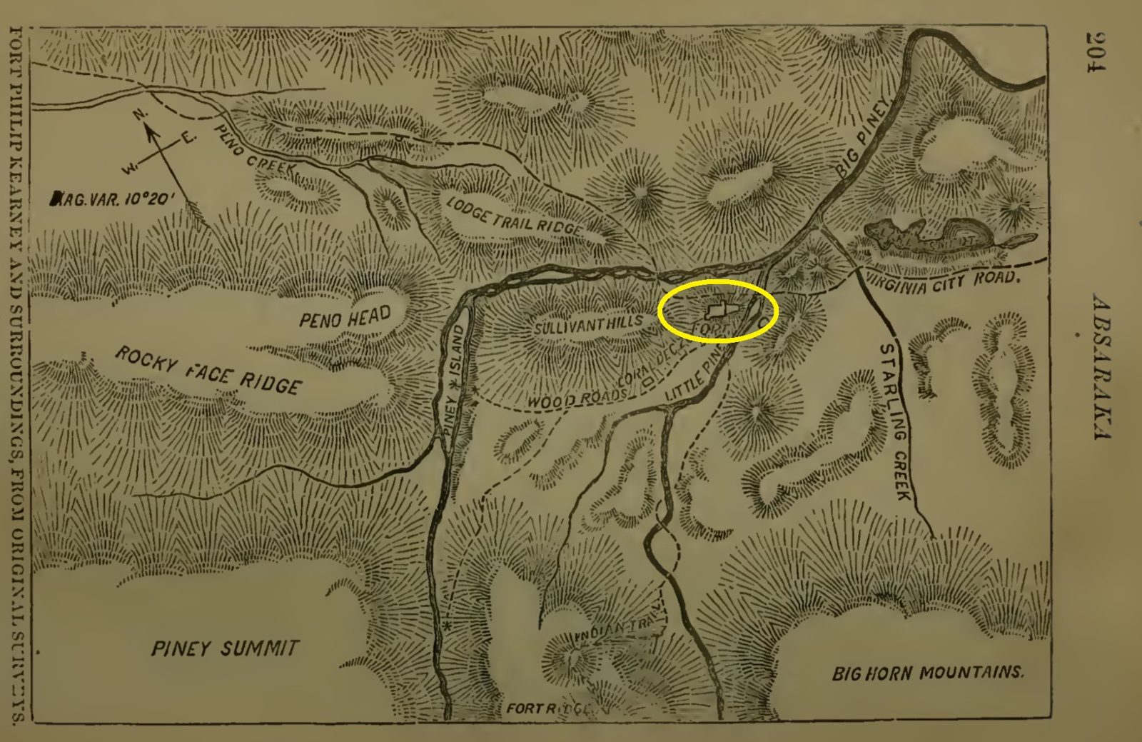
Henry B. Carrington (in Margaret Carrington, Ab-Sa-Ra-Ka, Land of Massacre) · 1868 survey, published 1878
Public domain · Wikimedia Commons
Maps from the Army's own history of the landing, written in 1945 from interviews with the men who made it.
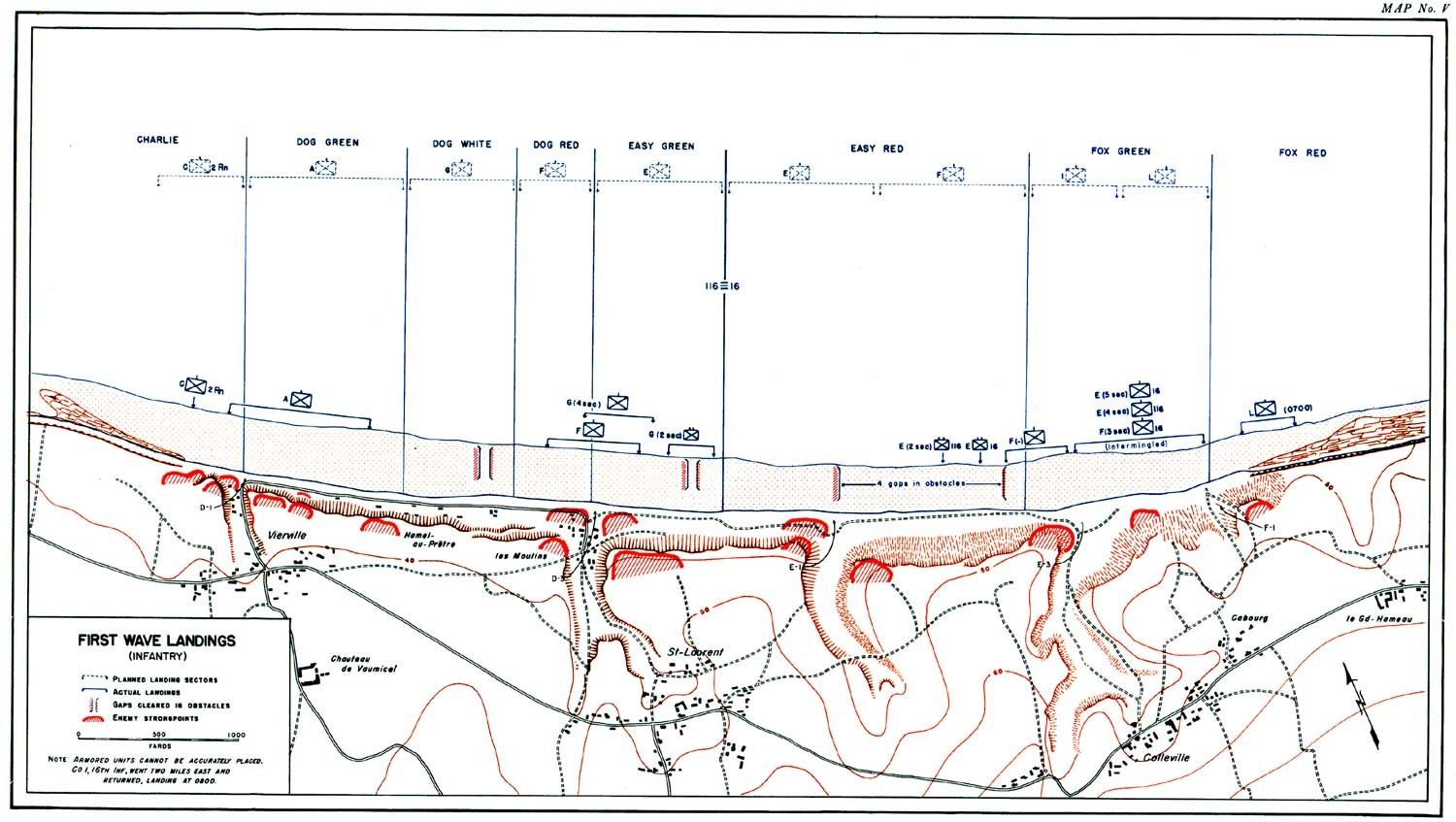
U.S. Army, War Department Historical Division · 1945
Public domain (U.S. government work) · From Omaha Beachhead (American Forces in Action series)
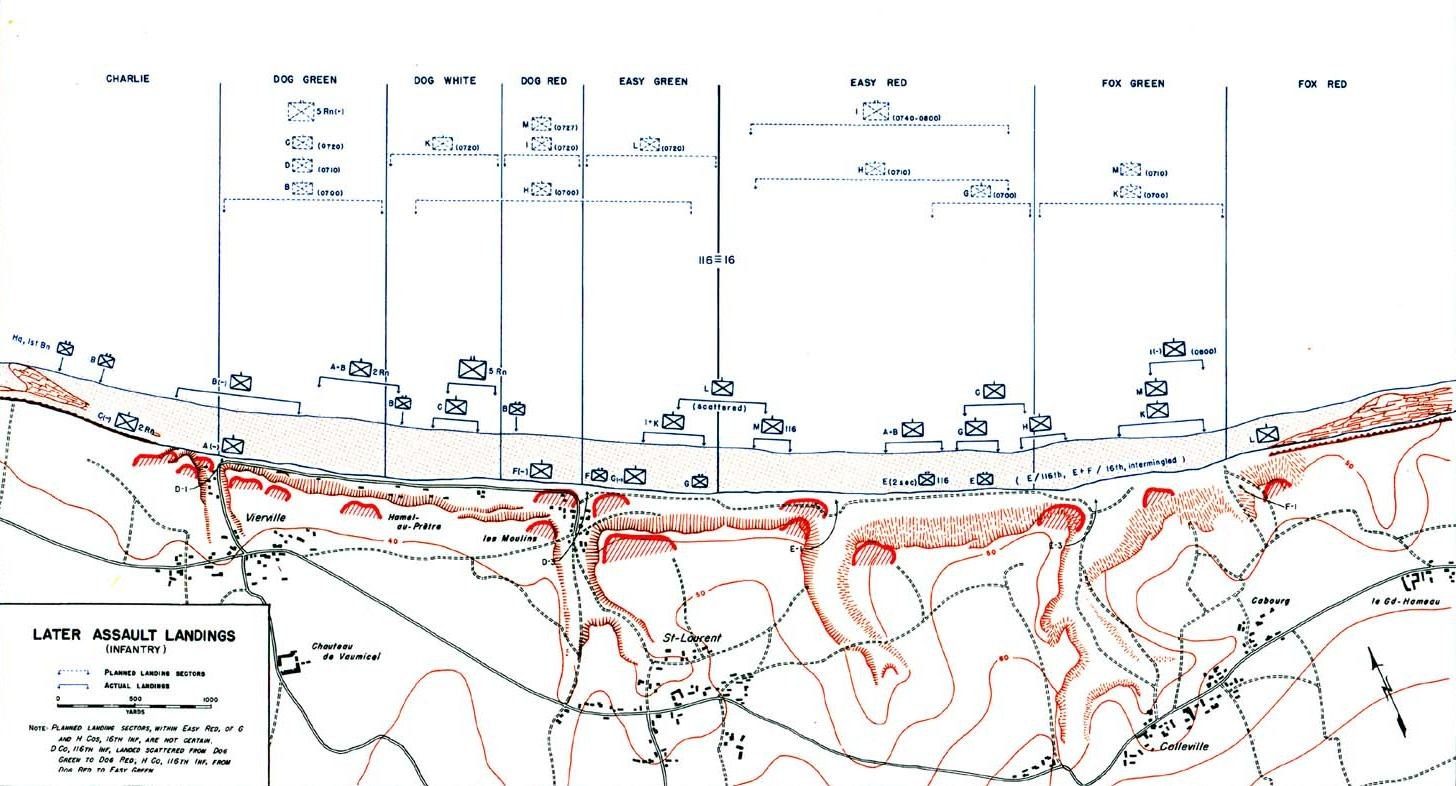
U.S. Army, War Department Historical Division · 1945
Public domain (U.S. government work) · From Omaha Beachhead (American Forces in Action series)
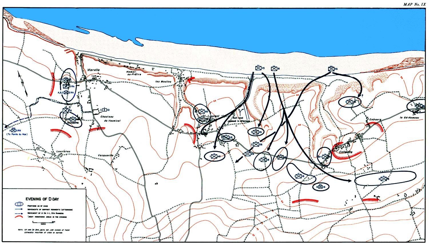
U.S. Army, War Department Historical Division · 1945
Public domain (U.S. government work) · From Omaha Beachhead (American Forces in Action series)
The Marine Corps' map of the landing beaches below Mount Suribachi.

U.S. Marine Corps, History Division · 1945
CC BY 2.0 · USMC Archives, via Wikimedia Commons
Army sketches of Landing Zone X-Ray drawn for the after-action reports.

U.S. Army · 1965
Public domain (U.S. government work) · Wikimedia Commons

U.S. Army · 1965
Public domain (U.S. government work) · Wikimedia Commons
Most are public domain: 19th- and early 20th-century surveys and U.S. government work. Hal Jespersen's and Charles Frye's modern maps are shared under Creative Commons licences that allow reuse with credit; follow each map's "Source and licence" link for the exact terms. The georeferenced versions were fitted to modern terrain by Battlefield Atlas, and their accuracy varies by map (see each battle's placement-confidence score).