Battlefield Atlas
American Civil War · 1862 First 3 stages free

Second Bull Run, 28–30 August 1862

Also known as Second Manassas

Between 28 and 30 August 1862, on the same ground as the first battle of 1861, Robert E. Lee's Army of Northern Virginia defeated John Pope's Army of Virginia, reinforced by part of McClellan's Army of the Potomac. Stonewall Jackson, after a march around Pope's flank and the burning of the Union depot at Manassas Junction, took a hidden position on an unfinished railroad near Groveton and opened the battle at Brawner's Farm. Through 29 August Pope threw piecemeal attacks against Jackson's line while Longstreet's wing arrived, unseen by Pope, on Jackson's right. On the 30th Pope's largest assault broke against the Deep Cut, and Longstreet's counterattack of some 25,000–30,000 men by different counts — one of the largest single assaults of the war — smashed the Union left. Stands at Chinn Ridge and Henry Hill bought time for Pope to withdraw across Bull Run that night. Strengths are usually given as about 62,000–70,000 Union and about 50,000–55,000 Confederate; losses as about 13,800–14,500 Union and 7,400–9,500 Confederate, depending on the source (the National Park Service's Civil War Sites Advisory Commission summary gives 13,826 and 8,353; the American Battlefield Trust 14,462 and 7,387).

Play the first 3 stages free8 stages on modern satellite imagery and terrain, with 3D elevation

The first 3 of its 8 stages are free to play. The rest opens with Battlefield Explorer ($4.99 a month or $39 a year), which unlocks every battle in the atlas and every one added later. Lifetime access and war packs are one-time options. Free battles include Thermopylae, Plataea, Actium, Viking raid on Lindisfarne, Hastings, Hattin, Agincourt, Vítkov Hill, Kutná Hora, Fall of Constantinople, First St Albans, Lützen, Siege of Buda, Culloden, Fort William Henry, Yorktown, Lake Erie, Waterloo, The Alamo, Monterrey, Antietam, Little Bighorn, Manila Bay, Belleau Wood, Saint-Mihiel, Omaha Beach, Inchon, Ia Drang, Goose Green, 73 Easting, Wanat, Baghdad Thunder Runs, Manbij, Battle of Raqqa, Donetsk Airport, Ilovaisk, Debaltseve, Battle of Kyiv, Battle of Hostomel Airport, Siege of Mariupol, Bilohorivka (Siverskyi Donets crossing), Kharkiv counteroffensive, Kherson counteroffensive, Bakhmut, Vuhledar, Mala Tokmachka and Robotyne, Avdiivka, Kursk incursion.

Second day of Second Bull Run (Forbes)
Second day of Second Bull Run (Forbes) — Edwin Forbes, Frank Leslie's Illustrated Newspaper · public domain

The battle, stage by stage

  1. 28 August 1862, about 6:30–9 PM

    Brawner's Farm

    After burning Pope's supply depot at Manassas Junction, Stonewall Jackson has hidden his wing — about 20,000–24,000 men — in the woods north of the Warrenton Turnpike near Groveton, waiting for Longstreet. Late in the afternoon Brig. Gen. Rufus King's Union division marches east along the turnpike across his front. Jackson opens with artillery; Captain Joseph Campbell's Battery B, 4th U.S. Artillery answers from Battery Heights, and Brig. Gen. John Gibbon sends his brigade of Wisconsin and Indiana men, mostly untried in a stand-up fight, through the Brawner farm to drive the guns off. Instead they meet Jackson's infantry in force; two of Doubleday's regiments, the 56th Pennsylvania and 76th New York, come up between the 7th and 6th Wisconsin. The lines stand in the open and trade volleys at a range the park's waysides give as 50 yards and A. Wilson Greene as about 75, for more than an hour and on into the dark. Trimble's and Lawton's brigades come forward against the Union right; Ewell is badly wounded (he loses a leg) and William Taliaferro is wounded. About 9 PM Gibbon and Doubleday fall back to the turnpike. The park counts 725 of Gibbon's 1,937 men, 236 of about 550 in Doubleday's two regiments and 340 of 850 in the Stonewall Brigade as casualties; Greene puts the totals at about 1,150 Union and 1,250 Confederate. King's division slips away that night, and Pope, now sure where Jackson is, orders his army to converge on him.

  2. 29 August, 7–10 AM

    Jackson on the unfinished railroad

    Jackson has drawn his line behind the grade of an unfinished railroad that runs from Sudley Church nearly two miles south-west toward the Brawner farm — cuts and fills that make ready-made breastworks. A.P. Hill's division holds the left near Sudley, with Gregg's South Carolinians and Thomas's Georgians in front; Lawton's (Ewell's) division the center; Starke's division the right, around a gap in the grade called 'The Dump' and the 'Deep Cut'. Franz Sigel's corps and Reynolds's Pennsylvania Reserves, fewer than 12,000 men, open the day: Schurz's division moves up the Manassas-Sudley Road against Hill, Milroy's brigade strikes Lawton near the Groveton-Sudley road, where part of the 82nd Ohio briefly breaks in at The Dump, and Schenck and Reynolds stay in the woods south of the turnpike under artillery fire. By 10 AM the attacks have stalled. Kearny's division, on Hill's far left, does not advance.

  3. 29 August, noon–3:30 PM

    Grover breaks in — and Longstreet arrives

    From late morning Longstreet's wing, through Thoroughfare Gap, files into line on Jackson's right, overlapping the Union left: Hood's division astride the turnpike, Kemper south of it, D.R. Jones far to the south on the Manassas-Gainesville road; Lee, Longstreet and Jackson confer near the Brawner farm in late morning. Pope, who reaches the field about 1 PM, does not grasp that Longstreet is there. At Dawkins Branch about 10,000 men of Porter's V Corps meet Confederate skirmishers about 11:30 AM; seeing dust and growing numbers in front, Porter does not attack — a choice that brings him a court-martial and dismissal in January 1863; a board under Gen. John Schofield cleared him in 1879, President Arthur remitted the rest of his sentence in 1882, and Congress restored his commission in 1886. About 3 PM Cuvier Grover's brigade of about 1,500, bayonets fixed, charges the railroad in silence, waits out a volley, and breaks through between Thomas and Gregg. No support comes: Gregg hits its flank and Pender's North Carolinians its front, and in about twenty minutes Grover loses 487 men, about a third of his command. Nagle's brigade of Reno's corps, attacking without support, briefly pierces Trimble's line near the Groveton-Sudley road and is driven back by a counterattack led by Bradley Johnson with a fresh Louisiana brigade.

  4. 29 August, 5–8 PM

    Kearny's attack and the twilight clash

    About 5 PM Phil Kearny throws nearly 3,000 men, with Leasure's brigade of Reno's corps on his left, at Jackson's far left near Sudley Church. Hill's brigades there have been hammered all day; Gregg's South Carolinians, by the park's count about 1,200 strong, have held a rocky knoll against six assaults and are nearly out of cartridges. The Federals reach the railroad and Hill's line bends back toward the church before Branch's brigade and then Early's, shifted from Jackson's right, drive them off. Gregg loses about half his men. At dusk Pope, wrongly believing the Confederates are retreating, sends Hatch's division west along the turnpike; on the hill east of Groveton it runs into Hood's division probing east, and in the dark Hood's longer line drives it back and takes a gun. After midnight Hood pulls back to his afternoon line.

  5. 30 August, about 3–3:45 PM

    Porter attacks the Deep Cut

    The morning is quiet. Pope, still convinced Lee is retreating, orders a pursuit near midday, finds Jackson in place, and at 1 PM orders Porter's corps, with Hatch's division — about 10,000 men by the park's count — to assault Jackson's right. To strengthen the attack, Reynolds is pulled north of the turnpike, leaving only McLean's Ohio brigade on Chinn Ridge and Warren's two New York Zouave regiments near Groveton to cover the Union left. About 3 PM the Federals leave the woods along the Groveton-Sudley road and climb the open Dogan pasture, 300 to 600 yards deep, toward Starke's division: Stafford's Louisianians at The Dump, Bradley Johnson's Virginians in the Deep Cut, the Stonewall Brigade in the woods beyond. Some regiments reach the embankment, where both sides fire blindly over it and Confederates short of ammunition reportedly throw rocks. S.D. Lee's 18 guns on the heights north of the Brawner farm rake the attackers' flank, Jackson feeds in reserves, and in less than an hour the attack collapses.

  6. 30 August, 4–6 PM

    Longstreet's counterattack

    About 4 PM Lee and Longstreet loose Longstreet's wing — some 25,000–30,000 men by different counts, on a front about a mile and a half long — against a Union left that now holds only about 2,200 men south of the turnpike — McLean's and Warren's brigades. Hood's Texas Brigade leads, astride the turnpike. Warren's roughly 1,000 men near Groveton are overrun in less than ten minutes; the 5th New York loses 123 killed or mortally wounded, the heaviest such loss of any Union infantry regiment in a single action of the war. McLean's Ohioans, about 1,200 behind a rail fence on Chinn Ridge, rise and fire at under 100 yards and trade point-blank fire for about ten minutes before Corse's Virginians, with a Louisiana battery, flank them; the stand buys Pope about half an hour. Pope rushes in Tower's and Stiles's brigades of Ricketts's division and Sigel's Koltes and Krzyzanowski. Leppien's 5th Maine Battery, facing south toward the Chinn house, fires canister before it is overrun; the park wayside says the fight around its guns lasted about 45 minutes. Tower is badly wounded and Koltes killed, and the 5th Texas alone loses 225 men. The fight on the ridge buys Pope time to form a new line on Henry Hill. By 6 PM Longstreet holds Chinn Ridge.

  7. 30 August, about 6–7:30 PM

    The stand on Henry Hill

    Pope's last line stands on the western slope of Henry Hill, from the ruins of the Henry house south about half a mile, the infantry in the washed-out bed of the Sudley Road with batteries firing over them from the crest: Reynolds's Pennsylvania Reserves under Meade, Milroy's brigade and Sykes's regulars of Buchanan and Chapman (their exact order along the road varies by account). Benning's and G.T. Anderson's Georgians of D.R. Jones's division, about 3,000 — the largest single assault of Longstreet's offensive — cross Chinn Branch and charge the road, and Mahone's and Wright's brigades of R.H. Anderson's division work around the Union left toward the Henry house. R.H. Anderson does not press the opening. Repeated, disjointed assaults along a half-mile front fail to break the Sudley Road line, and darkness falls before the Confederates can concentrate. North of the turnpike Jackson's exhausted divisions advance about 6 PM, but by 7 PM Pope has an unbroken line there joined to Henry Hill.

  8. 30 August, 8–11 PM

    Retreat across Bull Run

    At 8 PM Pope orders a withdrawal. Covered by the regulars on Henry Hill, the army files east along the Warrenton Turnpike past the Stone House and over the Stone Bridge on Bull Run, the same crossing used in the rout of July 1861 — this time, by Greene's account, largely in good order — and by 11 PM is off the field and heading for Centreville. At dusk, south of the turnpike, Stuart's cavalry under Beverly Robertson strikes toward Lewis Ford to cut the line of retreat, but Brig. Gen. John Buford's Union cavalry brigade checks it in a short saber fight; Buford is wounded. Losses for the three days are about 13,800–14,500 Union and 7,400–9,500 Confederate by different counts. Lee's victory clears northern Virginia, and within a week his army crosses the Potomac into Maryland.

Forces

Pope had more men on the field (about 62,000–73,000 by different counts) than Lee (about 50,000–55,000), but fought Jackson piecemeal on 29 August and was caught with only a few thousand men facing Longstreet's 25,000–30,000 on the afternoon of the 30th. Army totals are approximate; several brigade figures come from park waysides and Greene's NPS history.

Confederate (Army of Northern Virginia: Jackson's and Longstreet's wings, Stuart's cavalry)

Jackson's wing on the unfinished railroad, 29 Augustabout 20,000

Greene: a line of some 3,000 yards defended by about 20,000 men. A. Wilson Greene, The Second Battle of Manassas (National Park Civil War Series, Eastern National, 2006), 'The Battle Begins' and 'August 29'

Benning's and G.T. Anderson's Georgians at Henry Hill, 30 Augustabout 3,000

Greene: the largest single assault force of Longstreet's offensive. A. Wilson Greene, The Second Battle of Manassas (National Park Civil War Series, Eastern National, 2006), conclusion

Union (Pope's Army of Virginia, with Army of the Potomac units)

Union troops south of the turnpike when Longstreet attacked, 30 Augustabout 2,200

Greene, after Reynolds was pulled north; elsewhere he puts 8,000 Federals south of the turnpike against Longstreet's 30,000, counting the reinforcements sent to Chinn Ridge. A. Wilson Greene, The Second Battle of Manassas (National Park Civil War Series, Eastern National, 2006), 'August 30'; A. Wilson Greene, The Second Battle of Manassas (National Park Civil War Series, Eastern National, 2006)

Gibbon's brigade at Brawner's Farm, 28 August1,937

Park wayside 'A Stand Up Fight' (2nd, 6th and 7th Wisconsin and 19th Indiana); it lost 725. National Park Service, Manassas National Battlefield Park, wayside 'A Stand Up Fight' (Brawner Farm); Historical Marker Database, 'A Stand Up Fight' (HMdb 58808)

Casualties

About 21,800–24,000 men were killed, wounded, captured or missing in three days: roughly 13,800–14,500 Union and 7,400–9,500 Confederate, depending on the count (NPS CWSAC 13,826 and 8,353; American Battlefield Trust 14,462 and 7,387). Union figures are fairly firm; Confederate returns were incomplete, so their total varies more. Certainty: fair.

Confederate (Army of Northern Virginia: Jackson's and Longstreet's wings, Stuart's cavalry)

Casualties (killed, wounded, missing and captured), 28–30 Augustabout 7,400–9,500 (7,387–9,474)

The National Park Service's Civil War Sites Advisory Commission summary gives 8,353; the American Battlefield Trust 7,387; the park's 1953 historical handbook 9,474 (the park's Battery Heights tablet says about 9,500). Confederate returns were incomplete. National Park Service, Civil War Sites Advisory Commission battle summary, 'Manassas II' (VA026); American Battlefield Trust, 'Second Manassas' (battle facts); National Park Service, Historical Handbook No. 15, Manassas (Bull Run) National Battlefield Park (1953), 'Second Manassas'

Killed, wounded, missing (breakdowns as each source gives them)1,096 killed, 6,202 wounded, 89 missing and captured (ABT)

The 1953 park handbook gives 1,553 killed, 7,812 wounded and 109 captured or missing; A. Wilson Greene says Lee lost 1,300 killed and more than 7,000 wounded. American Battlefield Trust, 'Second Manassas' (battle facts); National Park Service, Historical Handbook No. 15, Manassas (Bull Run) National Battlefield Park (1953), 'Second Manassas'; A. Wilson Greene, The Second Battle of Manassas (National Park Civil War Series, Eastern National, 2006), conclusion

Casualties at Brawner's Farm, 28 Augustabout 1,250

Greene; nearly one in three men engaged there fell. The park wayside says the Stonewall Brigade alone lost 340 of 850 men. A. Wilson Greene, The Second Battle of Manassas (National Park Civil War Series, Eastern National, 2006), 'The Battle Begins' and 'August 29'; National Park Service, Manassas National Battlefield Park, wayside 'A Stand Up Fight' (Brawner Farm)

5th Texas (Hood's Texas Brigade), killed and wounded225

Greene: 'The Fifth Texas alone lost 225 men killed and wounded at Manassas.' A. Wilson Greene, The Second Battle of Manassas (National Park Civil War Series, Eastern National, 2006), 'August 30'

Union (Pope's Army of Virginia, with Army of the Potomac units)

Casualties (killed, wounded, missing and captured), 28–30 Augustabout 13,800–14,500 (13,826–14,462)

The NPS Civil War Sites Advisory Commission summary gives 13,826; the American Battlefield Trust and the 1953 park handbook 14,462 (the park's Battery Heights tablet says about 14,300). Greene writes that Pope lost nearly 10,000 not counting captured and missing. National Park Service, Civil War Sites Advisory Commission battle summary, 'Manassas II' (VA026); American Battlefield Trust, 'Second Manassas' (battle facts); National Park Service, Historical Handbook No. 15, Manassas (Bull Run) National Battlefield Park (1953), 'Second Manassas'; A. Wilson Greene, The Second Battle of Manassas (National Park Civil War Series, Eastern National, 2006), conclusion

Killed, wounded, missing and captured1,747 killed, 8,452 wounded, 4,263 missing and captured

American Battlefield Trust; the same figures appear in the 1953 park handbook. American Battlefield Trust, 'Second Manassas' (battle facts); National Park Service, Historical Handbook No. 15, Manassas (Bull Run) National Battlefield Park (1953), 'Second Manassas'

Grover's brigade, 29 August (killed, wounded and missing)487

Greene: about a third of the brigade's 1,500 men, lost in about twenty minutes. A. Wilson Greene, The Second Battle of Manassas (National Park Civil War Series, Eastern National, 2006), 'The Battle Begins' and 'August 29'

5th New York, 30 August (killed or mortally wounded)123

The park calls it the greatest loss of life in any Union infantry regiment in a single action of the war. Nearby, Greene says McLean's Ohio brigade on Chinn Ridge suffered 33 percent casualties. Historical Marker Database, 'The Very Vortex of Hell' (5th New York, HMdb 58858); National Park Service, 'Auto Tour Stop 9: New York Monuments'; A. Wilson Greene, The Second Battle of Manassas (National Park Civil War Series, Eastern National, 2006), 'August 30'

Then and now: how the ground has changed

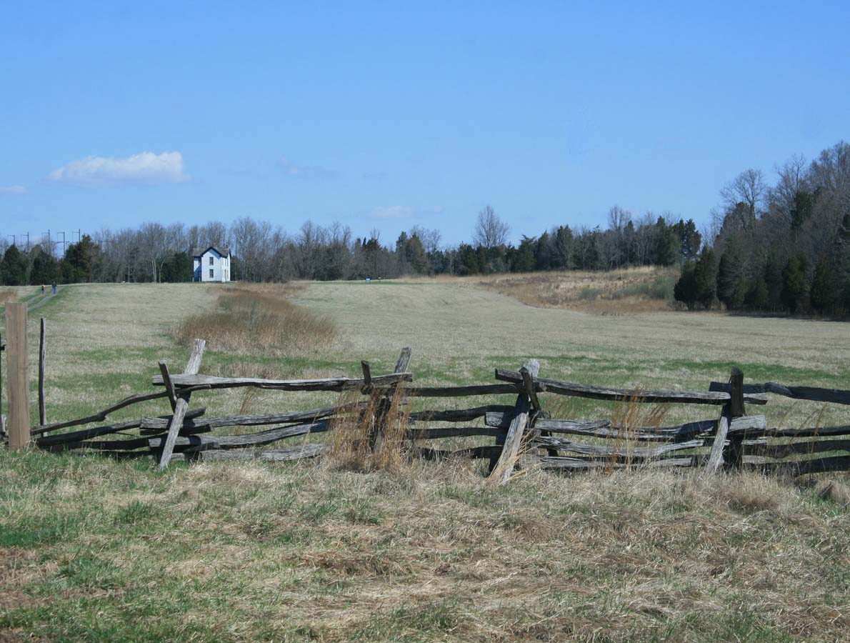
Most of the Second Manassas field, from the Brawner farm and the unfinished railroad to Chinn Ridge and Henry Hill, lies inside Manassas National Battlefield Park and is kept as open fields and woods, but the field-and-forest pattern has shifted since 1862, the Stone Bridge is a rebuilding, U.S. 29 still runs through the middle, and suburbs, I-66 and commercial development press on the edges. The park service rates the wider battlefield as much altered and fragmented, with essential features left.

Weapons

Confederate (Army of Northern Virginia: Jackson's and Longstreet's wings, Stuart's cavalry)

Pattern 1853 Enfield rifle-musket

Pattern 1853 Enfield rifle-musket

Rifled percussion musket · 1853–1867

At Second Bull Run: Many Confederate regiments carried imported Enfield rifle-muskets.

Britain's standard infantry rifle of the 1850s and, after the Springfield, the most common long arm of the Civil War. Both sides imported it by the hundreds of thousands; it fired the same family of hollow-based Minié bullets as the Springfield.

Caliber
.577
Effective range
about 300–500 yd (sighted to 900+)
Rate of fire
2–3 rounds a minute
Photo: Smithsonian Institution (NMAH) · Public domain

Union (Pope's Army of Virginia, with Army of the Potomac units)

Springfield Model 1861 rifle-musket

Springfield Model 1861 rifle-musket

Rifled percussion musket · 1861–1865

At Second Bull Run: Standard Union rifle-musket.

The Union's standard infantry weapon, made in the hundreds of thousands at Springfield Armory and by contractors. Its Minié bullet expanded into the rifling, giving rifle accuracy at musket loading speed, one reason Civil War assaults on prepared works were so costly.

Caliber
.58
Effective range
about 200–400 yd (sighted to 500)
Rate of fire
2–3 rounds a minute
Photo: Smithsonian Institution (NMAH) · Public domain
M1857 12-pounder "Napoleon"

M1857 12-pounder "Napoleon"

Smoothbore field gun (bronze) · 1857-1865 (U.S. service into the 1870s)

At Second Bull Run: Union batteries on Chinn Ridge and Henry Hill fired canister at close range.

A U.S. copy of a French gun-howitzer named for Emperor Napoleon III, the Napoleon fired a 12-pound ball but was light enough for field batteries. Rifled guns outranged it, but at the short ranges of most Civil War fighting its heavy canister made it the most trusted gun on both sides. It became the most common field piece of the war.

Caliber
4.62 in
Range
About 1,600-1,700 yd (solid shot at 5°)
Shot
Solid shot, shell, case shot, canister
Crew
9
Photo: Hal Jespersen · Public domain

Paintings and photographs

Second day of Second Bull Run (Forbes)
Second day of Second Bull Run (Forbes) The second day of the Second Battle of Bull Run, Saturday 30 August 1862, Pope's army against Lee, Jackson and Longstreet: wood engraving after a sketch by Edwin Forbes in Frank Leslie's Illustrated Newspaper, 20 September 1862. Scene not identified; pinned at Groveton, approximate. Edwin Forbes, Frank Leslie's Illustrated Newspaper · public domain · source
Battle of Gainesville (Dawes sketch)
Battle of Gainesville (Dawes sketch) Sketch of the Battle of Gainesville, the fight at the Brawner farm on 28 August 1862, drawn by Maj. Rufus Dawes of the 6th Wisconsin (published 1890). Pinned with the 6th Wisconsin of Gibbon's brigade. Rufus Dawes · public domain · source
Position of troops at sunset, 28 August
Position of troops at sunset, 28 August Map of the position of troops at sunset on 28 August 1862, the Brawner farm fight (1863). Pinned at the center of the area it covers, approximate. Unknown mapmaker · public domain · source
The battle of Groveton (Forbes drawing)
The battle of Groveton (Forbes drawing) Edwin Forbes's 1862 drawing The battle of Groveton or Second Bull Run (Library of Congress). Viewpoint not recorded; pinned at Groveton, approximate. Edwin Forbes (Library of Congress) · public domain · source
After the battle (Nast)
After the battle (Nast) Thomas Nast's engraving for Harper's Weekly, 1862, based on a New York Times eyewitness report, showing Confederate soldiers stripping the bodies of fallen Union soldiers and throwing them into mass graves after Second Bull Run. Place not recorded; pinned at the center of the battlefield, approximate. Thomas Nast, Harper's Weekly · public domain · source
Defeat of Pope's army on the old Bull Run battleground (Waud)
Defeat of Pope's army on the old Bull Run battleground (Waud) Alfred Waud's 1862 drawing Defeat of the Army of Genl. Pope at Manassas on the old Bull Run battleground, pencil and Chinese white on olive paper (Library of Congress). Viewpoint not recorded; pinned at Henry Hill, the center of the 1861 battlefield, approximate. Alfred R. Waud (Library of Congress) · public domain · source
Ruins of the Stone Bridge, Bull Run (March 1862)
Ruins of the Stone Bridge, Bull Run (March 1862) The Stone Bridge over Bull Run, wrecked by the Confederates when they left Manassas in March 1862, photographed that month by George N. Barnard and James F. Gibson; rebuilt, it carried Pope's retreat on the night of 30 August. George N. Barnard and James F. Gibson, March 1862 · public domain · source
Sigel's survey of the battlefield, November 1862
Sigel's survey of the battlefield, November 1862 Map of the battlefield of Bull Run, 29 and 30 August 1862, surveyed by order of Maj. Gen. Franz Sigel under Maj. Kappner by G. Stengel and Ulric de Fonvielle, November 1862 (NARA 305590). Pinned at the center of the battlefield. Ulric de Fonvielle and G. Stengel (NARA) · public domain · source
Sneden's battle map of Second Bull Run
Sneden's battle map of Second Bull Run Robert Knox Sneden's original battle map of Second Bull Run, 1862. Pinned at the center of the battlefield. Robert Knox Sneden · public domain · source
Positions and movements, 29 August (plate 2)
Positions and movements, 29 August (plate 2) Battle of Bull Run or Manassas, giving positions and movements of troops, 29 August 1862, plate 2 (NARA 137930551). Pinned at the center of the battlefield. U.S. government (NARA) · public domain · source
Positions and movements, 30 August (plate 5)
Positions and movements, 30 August (plate 5) Battle of Bull Run or Manassas, giving positions and movements of troops, 30 August 1862, plate 5 (NARA 137930553). Pinned at the center of the battlefield. U.S. government (NARA) · public domain · source
Pope's map of both armies, night of 27 August
Pope's map of both armies, night of 27 August Map showing the positions of both armies on the night of 27 August 1862, from Pope's report to the Joint Committee on the Conduct of the War (1866) (Library of Congress). It covers a wide area; pinned at the center of the battlefield, approximate. John Pope (Library of Congress) · public domain · source
Warren map of the battlegrounds, 28–30 August (Engineer Department)
Warren map of the battlegrounds, 28–30 August (Engineer Department) Map of the battlegrounds of 28, 29 and 30 August 1862 in the vicinity of Groveton, Engineer Department, U.S. Army, 1878, prepared for the Porter inquiry under G. K. Warren (Library of Congress). G. K. Warren, Engineer Department (Library of Congress) · public domain · source
Warren map with the petitioner's positions
Warren map with the petitioner's positions The same 1878 Warren map of the Groveton battlegrounds as an illustrative map accompanying the argument of Fitz John Porter's counsel, with troop positions (Library of Congress). G. K. Warren (Library of Congress) · public domain · source
Battle grounds in the vicinity of Groveton (NARA)
Battle grounds in the vicinity of Groveton (NARA) Battle grounds of 28, 29 and 30 August 1862 in the vicinity of Groveton, 1878, page 1 (NARA 137930520). U.S. government (NARA) · public domain · source
Judson map of positions on 30 August
Judson map of positions on 30 August Map of the battlefield of Manassas giving positions and movements of troops on 30 August 1862, by J. A. Judson, 1878; positions were given in testimony before the Army board at West Point (Library of Congress). J. A. Judson (Library of Congress) · public domain · source
Warren and Judson map of positions on 30 August
Warren and Judson map of positions on 30 August A second 1878 edition of the map of the battlefield of Manassas giving positions and movements of troops on 30 August 1862, by G. K. Warren and J. A. Judson (Library of Congress). G. K. Warren and J. A. Judson (Library of Congress) · public domain · source
Century map: sunset, 29 August
Century map: sunset, 29 August Second Battle of Bull Run: position of troops at sunset, 29 August 1862, by Jacob Wells for the Century magazine, January 1886 (Library of Congress). Jacob Wells (Library of Congress) · public domain · source
Century map: the last day, 30 August
Century map: the last day, 30 August Second Battle of Bull Run: positions of troops on 30 August 1862, the last day's fighting, by Jacob Wells for the Century magazine, February 1886 (Library of Congress). Jacob Wells (Library of Congress) · public domain · source
Ferrero's brigade on Henry House Hill
Ferrero's brigade on Henry House Hill Sketch map of 1882 showing the position of Ferrero's brigade during the Union rear-guard action on Henry House Hill. Unknown artist · public domain · source
Map: 28 August
Map: 28 August Modern map of the Second Battle of Bull Run, 28 August 1862. Pinned near the center of the area it covers. Hal Jespersen · CC BY 3.0 · source
Map: 29 August, 10 AM
Map: 29 August, 10 AM Modern map of the Second Battle of Bull Run, 29 August, 10 AM 1862. Pinned near the center of the area it covers. Hal Jespersen · CC BY 3.0 · source
Map: 29 August, noon
Map: 29 August, noon Modern map of the Second Battle of Bull Run, 29 August, noon 1862. Pinned near the center of the area it covers. Hal Jespersen · CC BY 3.0 · source
Map: 29 August, 3 PM
Map: 29 August, 3 PM Modern map of the Second Battle of Bull Run, 29 August, 3 PM 1862. Pinned near the center of the area it covers. Hal Jespersen · CC BY 3.0 · source
Map: 29 August, 5 PM
Map: 29 August, 5 PM Modern map of the Second Battle of Bull Run, 29 August, 5 PM 1862. Pinned near the center of the area it covers. Hal Jespersen · CC BY 3.0 · source
Map: 30 August, 3 PM
Map: 30 August, 3 PM Modern map of the Second Battle of Bull Run, 30 August, 3 PM 1862. Pinned near the center of the area it covers. Hal Jespersen · CC BY 3.0 · source
Map: 30 August, 4 PM
Map: 30 August, 4 PM Modern map of the Second Battle of Bull Run, 30 August, 4 PM 1862. Pinned near the center of the area it covers. Hal Jespersen · CC BY 3.0 · source
Map: 30 August, 4:30 PM
Map: 30 August, 4:30 PM Modern map of the Second Battle of Bull Run, 30 August, 4:30 PM 1862. Pinned near the center of the area it covers. Hal Jespersen · CC BY 3.0 · source
Map: 30 August, 5 PM
Map: 30 August, 5 PM Modern map of the Second Battle of Bull Run, 30 August, 5 PM 1862. Pinned near the center of the area it covers. Hal Jespersen · CC BY 3.0 · source
The Brawner farm today
The Brawner farm today The Brawner farm and the Groveton road fence, the field of Gibbon's brigade's fight (photo 2015). Muhranoff · CC BY-SA 4.0 · source
Groveton today
Groveton today The site of the former crossroads hamlet of Groveton (photo 2015). Muhranoff · CC BY-SA 4.0 · source
Groveton Confederate Cemetery
Groveton Confederate Cemetery The Groveton Confederate Cemetery in Manassas National Battlefield Park, 2003. Not marked on this map; pinned at Groveton, approximate. William Fleitz, Manassas National Battlefield Park · public domain · source
5th New York monument
5th New York monument The monument to the 5th New York (Duryée's Zouaves), destroyed here on 30 August 1862, 2013. Sj2z · CC BY-SA 3.0 · source
14th Brooklyn monument
14th Brooklyn monument The monument to the 14th Brooklyn, which fought at First Bull Run, Gainesville, Groveton and Second Bull Run, 2018. Dennis H. Begeal · CC BY-SA 4.0 · source
14th Brooklyn monument (2003)
14th Brooklyn monument (2003) The monument to the 14th Brooklyn (84th New York) in Manassas National Battlefield Park, 2003. William Fleitz, Manassas National Battlefield Park · public domain · source
Battery Heights
Battery Heights Battery Heights in autumn, 2004. Manassas National Battlefield Park · CC BY 2.0 · source
The Stone House today
The Stone House today The fence around the Stone House, Manassas National Battlefield Park, May 2013. Famartin · CC BY-SA 3.0 · source

★ Medal of Honor 5 recipients

Links go to the official records: the Congressional Medal of Honor Society and, where they exist, the service's own pages.

Free for everyone every year on its anniversary: August 28–30.

Accuracy score: 78/100 (good)

How the accuracy score works

Sources and method

Second Bull Run (Second Manassas), 28–30 August 1862. Units are placed from the Manassas National Battlefield Park waysides and monuments (Brawner Farm, Battery Heights, the S.D. Lee artillery position, Sudley Church and the rocky knoll, Gregg's brigade, Grover's attack, the Unfinished Railroad, the Rock Fight and Deep Cut, the 13th New York, Groveton, the 14th Brooklyn and 5th New York monuments, the Chinn Ridge exhibits, the Sudley Road cut, Henry Hill, the Stone House and the Stone Bridge), with positions from the Historical Marker Database (hmdb.org), and the Prince William County marker for Porter at Dawkins Branch. Jackson's line is drawn along the unfinished railroad grade through those markers. The course of the battle, brigade order, times and many figures follow A. Wilson Greene, The Second Battle of Manassas (National Park Civil War Series, Eastern National, 2006); the wayside texts; the National Park Service's Deep Cut page; and the American Battlefield Trust's Second Manassas battle page and maps (strengths about 70,000 Union and 55,000 Confederate; losses 14,462 and 7,387). Britannica gives 13,824 and 8,353; the park's Battery Heights tablet about 14,300 and 9,500. John J. Hennessy's Return to Bull Run (1993) and his NPS troop-movement study of 1985 are the standard detailed studies. The U.S. Army Center of Military History's Second Bull Run Staff Ride: Briefing Book (Ted Ballard and Billy Arthur, 2000) covers the battle. Brigade frontages and the exact order of the Union units on Henry Hill are interpretive; the positions of Longstreet's right on 29 August, of D.R. Jones's division and of the Lewis Ford cavalry fight are approximate. Images from Wikimedia Commons.

Where the positions come from

Further reading